Area Overview for WR11 4PP
Photos of WR11 4PP
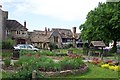
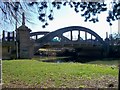
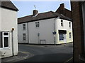

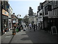
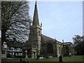
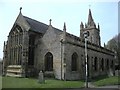
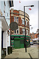
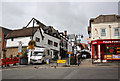
100 photos from this area
Area Information
Key information about the WR11 4PP including its size, population, and administrative classification.
- Area Type
- Postcode
- Area Size
- 8442 m²
- Population
- 1289
- Population Density
- 2815 people/km²
House Prices in WR11 4PP
54
Properties
£134,925
Average Sold Price
£47,500
Lowest Price
£179,000
Highest Price
Showing 54 properties
| Address | Type | Beds | Baths | Last Sale Price | Last Sale Date | |
|---|---|---|---|---|---|---|
| 7 Mill Street, Evesham, WR11 4PP | Terraced | 2 | 1 | £175,000 | Aug 2025 | |
| 12 Mill Street, Evesham, WR11 4PP | Terraced | 2 | 1 | £179,000 | Aug 2024 | |
| 13 Mill Street, Evesham, WR11 4PP | Terraced | 2 | 2 | £160,000 | Oct 2023 | |
| 10 Mill Street, Evesham, WR11 4PP | Terraced | 2 | - | £163,000 | May 2023 | |
| 41 Mill Street, Evesham, WR11 4PP | Terraced | 3 | 1 | £148,000 | Jun 2022 | |
| 18 Mill Street, Evesham, WR11 4PP | Terraced | 2 | 1 | £144,000 | Nov 2021 | |
| 42 Mill Street, Evesham, WR11 4PP | Terraced | 3 | - | £135,000 | Feb 2020 | |
| 11 Mill Street, Evesham, WR11 4PP | Terraced | 2 | 1 | £140,000 | Nov 2019 | |
| 8 Mill Street, Evesham, WR11 4PP | Terraced | 3 | 1 | £157,000 | Jul 2019 | |
| 9 Mill Street, Evesham, WR11 4PP | Terraced | 3 | 1 | £119,000 | Oct 2016 |
Page 1 of 6
Energy Efficiency in WR11 4PP
Amenities
Schools
| Rank | School | Type | Entry gender | Ages |
|---|
Explore more schools in this area
Go to Schools tabDemographics
Household Size
One person
most common
Accommodation Type
Flats
most common
Tenure
33
majority
Ethnic Group
White
most common
Religion
N/A
most common
Household Composition
N/A
most common
Age
47
median
Adults (30-64 years)
most common
Household Deprivation
N/A
with no deprivation
NS-SEC
23
in Lower managerial occupations
Explore more demographic insights in this area
Go to Demographics tabPlanning
Planning Constraints
- Flood RiskPremium
- Ramsar Wetland SitesPremium
- Area of Outstanding Natural BeautyPremium
- Protected Nature ReservePremium
- Protected WoodlandPremium