Area Overview for WR11 4EU
Photos of WR11 4EU
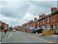
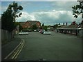
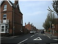
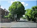
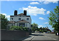
96 photos from this area
Area Information
Key information about the WR11 4EU including its size, population, and administrative classification.
- Area Type
- Postcode
- Area Size
- 9147 m²
- Population
- 1902
- Population Density
- 2779 people/km²
House Prices in WR11 4EU
27
Properties
-
Average Sold Price
-
Lowest Price
-
Highest Price
Showing 27 properties
| Address | Type | Beds | Baths | Last Sale Price | Last Sale Date | |
|---|---|---|---|---|---|---|
| Flat 3, 104 High Street, Evesham, WR11 4EU | Flat | 2 | 1 | - | - | |
| Flat 2, 104 High Street, Evesham, WR11 4EU | Flat | 2 | - | - | - | |
| The Flat, 96 High Street, Evesham, WR11 4EU | Office | - | - | - | - | |
| Action On Pre Eclamsia Limited, The Stables Rear Of, 80 High Street, Evesham, WR11 4EU | Office | - | - | - | - | |
| First And Second Floor, 94 High Street, Evesham, WR11 4EU | Office | - | - | - | - | |
| Offices First Floor, 90 High Street, Evesham, WR11 4EU | Office | - | - | - | - | |
| Room 1 At, 94 High Street, Evesham, WR11 4EU | Office | - | - | - | - | |
| Flat 1, 80 High Street, Evesham, WR11 4EU | Flat | - | - | - | - | |
| Flat 3, 80 High Street, Evesham, WR11 4EU | Flat | - | - | - | - | |
| High Street Dental Practice, 102 High Street, Evesham, WR11 4EU | primary_healthcare | - | - | - | - |
Page 1 of 3
Energy Efficiency in WR11 4EU
Amenities
Schools
| Rank | School | Type | Entry gender | Ages |
|---|
Explore more schools in this area
Go to Schools tabDemographics
Household Size
One person
most common
Accommodation Type
Houses
most common
Tenure
32
majority
Ethnic Group
White
most common
Religion
N/A
most common
Household Composition
N/A
most common
Age
47
median
Adults (30-64 years)
most common
Household Deprivation
N/A
with no deprivation
NS-SEC
17
in Lower managerial occupations
Explore more demographic insights in this area
Go to Demographics tabPlanning
Planning Constraints
- Flood RiskPremium
- Ramsar Wetland SitesPremium
- Area of Outstanding Natural BeautyPremium
- Protected Nature ReservePremium
- Protected WoodlandPremium