Area Overview for WR10 3NZ
Photos of WR10 3NZ
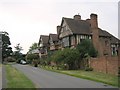
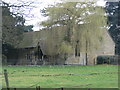
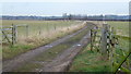
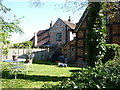
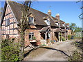
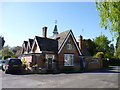
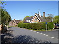
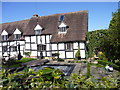
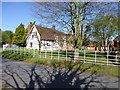
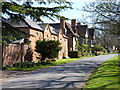
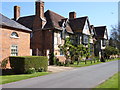

76 photos from this area
Area Information
Key information about the WR10 3NZ including its size, population, and administrative classification.
- Area Type
- Postcode
- Area Size
- 18.4 hectares
- Population
- 1486
- Population Density
- 73 people/km²
House Prices in WR10 3NZ
41
Properties
£375,294
Average Sold Price
£152,000
Lowest Price
£690,000
Highest Price
Showing 41 properties
| Address | Type | Beds | Baths | Last Sale Price | Last Sale Date | |
|---|---|---|---|---|---|---|
| 1, Woodbine Cottages, Main Street, Wick, WR10 3NZ | house | - | - | £375,000 | Apr 2025 | |
| Meadow House, Main Street, Wick, WR10 3NZ | house | - | - | £495,950 | Sep 2023 | |
| 2, Woodbine Cottages, Main Street, Wick, WR10 3NZ | house | - | - | £350,000 | Feb 2021 | |
| 3, White Oaks, Main Street, Wick, WR10 3NZ | Cottage | 3 | 1 | £312,750 | Dec 2019 | |
| Taylors Cottage, Main Street, Wick, WR10 3NZ | Detached | - | - | £250,000 | Mar 2019 | |
| Whitegates, Main Street, Wick, WR10 3NZ | house | - | - | £380,000 | Sep 2018 | |
| Old Oak Cottage, Main Street, Wick, WR10 3NZ | Detached | 3 | 2 | £420,000 | Aug 2018 | |
| Glenmore House, Main Street, Wick, WR10 3NZ | Detached | 5 | 3 | £450,000 | Dec 2014 | |
| 4, White Oaks, Main Street, Wick, WR10 3NZ | house | 2 | - | £165,000 | Mar 2011 | |
| Lambourne House, Main Street, Wick, WR10 3NZ | Detached | - | - | £660,000 | Dec 2007 |
Page 1 of 5
Energy Efficiency in WR10 3NZ
Amenities
Schools
| Rank | School | Type | Entry gender | Ages |
|---|
Explore more schools in this area
Go to Schools tabDemographics
Household Size
Two person
most common
Accommodation Type
Houses
most common
Tenure
80
majority
Ethnic Group
White
most common
Religion
N/A
most common
Household Composition
N/A
most common
Age
47
median
Adults (30-64 years)
most common
Household Deprivation
N/A
with no deprivation
NS-SEC
41
in Lower managerial occupations
Explore more demographic insights in this area
Go to Demographics tabPlanning
Planning Constraints
- Flood RiskPremium
- Ramsar Wetland SitesPremium
- Area of Outstanding Natural BeautyPremium
- Protected Nature ReservePremium
- Protected WoodlandPremium