Area Overview for WR10 3AA
Photos of WR10 3AA


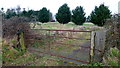

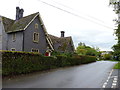
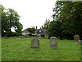
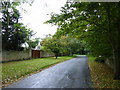
74 photos from this area
Area Information
Key information about the WR10 3AA including its size, population, and administrative classification.
- Area Type
- Postcode
- Area Size
- 52.4 hectares
- Population
- 1285
- Population Density
- 151 people/km²
House Prices in WR10 3AA
23
Properties
£656,833
Average Sold Price
£151,000
Lowest Price
£2,300,000
Highest Price
Showing 23 properties
| Address | Type | Beds | Baths | Last Sale Price | Last Sale Date | |
|---|---|---|---|---|---|---|
| 2, Court Cottages, Upper End, Birlingham, WR10 3AA | house | 2 | - | £212,000 | Feb 2025 | |
| Brockham, Upper End, Birlingham, WR10 3AA | Bungalow | 2 | 4 | £1,600,000 | Oct 2021 | |
| Coach House, Upper End, Birlingham, WR10 3AA | house | - | - | £510,000 | Oct 2021 | |
| 3, Court Cottages, Upper End, Birlingham, WR10 3AA | Terraced | 4 | 2 | £310,000 | Nov 2020 | |
| Rough Hill House, Upper End, Birlingham, WR10 3AA | Detached | 4 | 1 | £675,000 | Nov 2020 | |
| Court Barn, Upper End, Birlingham, WR10 3AA | house | 3 | - | £342,500 | Sep 2020 | |
| Hills Cottage, Upper End, Birlingham, WR10 3AA | house | - | - | £637,500 | Oct 2018 | |
| Court House, Upper End, Birlingham, WR10 3AA | house | 7 | - | £2,300,000 | Jun 2014 | |
| Maryworth Barn, Upper End, Birlingham, WR10 3AA | house | - | - | £442,000 | Nov 2010 | |
| The Old Dairy, Upper End, Birlingham, WR10 3AA | house | - | - | £370,000 | Nov 2007 |
Page 1 of 3
Energy Efficiency in WR10 3AA
Amenities
Schools
| Rank | School | Type | Entry gender | Ages |
|---|
Explore more schools in this area
Go to Schools tabDemographics
Household Size
Two person
most common
Accommodation Type
Houses
most common
Tenure
86
majority
Ethnic Group
White
most common
Religion
N/A
most common
Household Composition
N/A
most common
Age
47
median
Adults (30-64 years)
most common
Household Deprivation
N/A
with no deprivation
NS-SEC
45
in Lower managerial occupations
Explore more demographic insights in this area
Go to Demographics tabPlanning
Planning Constraints
- Flood RiskPremium
- Ramsar Wetland SitesPremium
- Area of Outstanding Natural BeautyPremium
- Protected Nature ReservePremium
- Protected WoodlandPremium