Area Overview for WR10 2LL
Photos of WR10 2LL
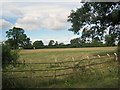

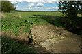
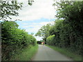
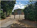
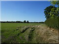
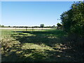
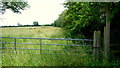
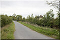
9 photos from this area
Area Information
Key information about the WR10 2LL including its size, population, and administrative classification.
- Area Type
- Postcode
- Area Size
- 44.7 hectares
- Population
- 1178
- Population Density
- 48 people/km²
House Prices in WR10 2LL
14
Properties
£371,905
Average Sold Price
£138,950
Lowest Price
£885,000
Highest Price
Showing 14 properties
| Address | Type | Beds | Baths | Last Sale Price | Last Sale Date | |
|---|---|---|---|---|---|---|
| Willowtree, Seaford Lane, Naunton Beauchamp, WR10 2LL | house | - | - | £500,000 | Dec 2020 | |
| Little Poplars, Seaford Lane, Naunton Beauchamp, WR10 2LL | house | - | - | £414,000 | Feb 2020 | |
| Fair Lea, Seaford Lane, Naunton Beauchamp, WR10 2LL | Bungalow | - | - | £395,000 | Aug 2019 | |
| Jubilee Court, B 4082 To North Piddle Lane, Naunton Beauchamp, WR10 2LL | Semi-detached | 5 | 5 | £885,000 | Jun 2019 | |
| Elder Cottage, Seaford Lane, Naunton Beauchamp, WR10 2LL | house | 3 | - | £410,000 | Oct 2018 | |
| Plumtree, Seaford Lane, Naunton Beauchamp, WR10 2LL | Bungalow | - | - | £412,500 | Nov 2015 | |
| The Old Smithy, Seaford Lane, Naunton Beauchamp, WR10 2LL | Detached | - | - | £185,000 | Sep 2012 | |
| Cherry Trees, Seaford Lane, Naunton Beauchamp, WR10 2LL | Bungalow | - | - | £325,000 | Aug 2010 | |
| Oldfield, Seaford Lane, Naunton Beauchamp, WR10 2LL | Detached | 4 | 2 | £278,000 | Nov 2008 | |
| The Bramblings, Seaford Lane, Naunton Beauchamp, WR10 2LL | Detached | - | - | £147,500 | Apr 2001 |
Page 1 of 2
Energy Efficiency in WR10 2LL
Amenities
Schools
| Rank | School | Type | Entry gender | Ages |
|---|
Explore more schools in this area
Go to Schools tabDemographics
Household Size
Two person
most common
Accommodation Type
Houses
most common
Tenure
89
majority
Ethnic Group
White
most common
Religion
N/A
most common
Household Composition
N/A
most common
Age
47
median
Adults (30-64 years)
most common
Household Deprivation
N/A
with no deprivation
NS-SEC
47
in Lower managerial occupations
Explore more demographic insights in this area
Go to Demographics tabPlanning
Planning Constraints
- Flood RiskPremium
- Ramsar Wetland SitesPremium
- Area of Outstanding Natural BeautyPremium
- Protected Nature ReservePremium
- Protected WoodlandPremium