Area Overview for WR10 1LY
Photos of WR10 1LY
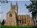


100 photos from this area
Area Information
Key information about the WR10 1LY including its size, population, and administrative classification.
- Area Type
- Postcode
- Area Size
- 1.1 hectares
- Population
- 1446
- Population Density
- 428 people/km²
House Prices in WR10 1LY
33
Properties
£200,722
Average Sold Price
£77,000
Lowest Price
£295,000
Highest Price
Showing 33 properties
| Address | Type | Beds | Baths | Last Sale Price | Last Sale Date | |
|---|---|---|---|---|---|---|
| 212 Farleigh Road, Pershore, WR10 1LY | Semi-detached | 4 | 2 | £295,000 | Apr 2025 | |
| 190 Farleigh Road, Pershore, WR10 1LY | house | 3 | 2 | £290,000 | Oct 2024 | |
| 166 Farleigh Road, Pershore, WR10 1LY | house | - | - | £240,000 | Aug 2021 | |
| 228 Farleigh Road, Pershore, WR10 1LY | house | - | - | £225,000 | Jan 2019 | |
| 204 Farleigh Road, Pershore, WR10 1LY | house | - | - | £280,000 | Jan 2018 | |
| 224 Farleigh Road, Pershore, WR10 1LY | house | - | - | £229,500 | Jul 2017 | |
| 170 Farleigh Road, Pershore, WR10 1LY | house | - | - | £234,000 | Aug 2016 | |
| Pervale, 188 Farleigh Road, Pershore, WR10 1LY | house | - | - | £206,000 | Aug 2016 | |
| 220 Farleigh Road, Pershore, WR10 1LY | Semi-detached | 3 | 2 | £210,000 | Apr 2016 | |
| 210 Farleigh Road, Pershore, WR10 1LY | house | - | - | £160,000 | Jan 2016 |
Page 1 of 4
Energy Efficiency in WR10 1LY
Amenities
Schools
| Rank | School | Type | Entry gender | Ages |
|---|
Explore more schools in this area
Go to Schools tabDemographics
Household Size
Two person
most common
Accommodation Type
Houses
most common
Tenure
74
majority
Ethnic Group
White
most common
Religion
N/A
most common
Household Composition
N/A
most common
Age
47
median
Adults (30-64 years)
most common
Household Deprivation
N/A
with no deprivation
NS-SEC
34
in Lower managerial occupations
Explore more demographic insights in this area
Go to Demographics tabPlanning
Planning Constraints
- Flood RiskPremium
- Ramsar Wetland SitesPremium
- Area of Outstanding Natural BeautyPremium
- Protected Nature ReservePremium
- Protected WoodlandPremium