Area Overview for WR10 1BY
Photos of WR10 1BY


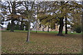
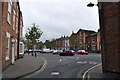
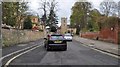
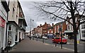
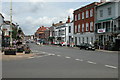
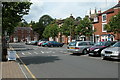
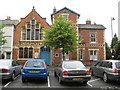

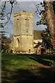
100 photos from this area
Area Information
Key information about the WR10 1BY including its size, population, and administrative classification.
- Area Type
- Postcode
- Area Size
- 2.3 hectares
- Population
- 1824
- Population Density
- 721 people/km²
House Prices in WR10 1BY
25
Properties
£189,791
Average Sold Price
£59,950
Lowest Price
£380,000
Highest Price
Showing 25 properties
| Address | Type | Beds | Baths | Last Sale Price | Last Sale Date | |
|---|---|---|---|---|---|---|
| Abbey View, New Road, Pershore, WR10 1BY | Semi-detached | 2 | 1 | £255,000 | Mar 2024 | |
| 8 New Road, Pershore, WR10 1BY | Terraced | 3 | 1 | £235,000 | Nov 2023 | |
| 11 New Road, Pershore, WR10 1BY | house | 3 | 1 | £265,000 | Feb 2023 | |
| Midway, New Road, Pershore, WR10 1BY | Bungalow | - | - | £380,000 | Aug 2022 | |
| 2 New Road, Pershore, WR10 1BY | Terraced | 3 | - | £187,000 | Jan 2021 | |
| Trees, New Road, Pershore, WR10 1BY | Bungalow | - | - | £255,000 | Jan 2021 | |
| Laxton, New Road, Pershore, WR10 1BY | house | - | - | £195,000 | May 2018 | |
| Crowcote House, New Road, Pershore, WR10 1BY | house | - | - | £245,000 | May 2017 | |
| Aran, New Road, Pershore, WR10 1BY | Bungalow | - | - | £243,000 | Dec 2015 | |
| 1 New Road, Pershore, WR10 1BY | Industrial | 2 | 1 | £144,000 | Jul 2011 |
Page 1 of 3
Energy Efficiency in WR10 1BY
Amenities
Schools
| Rank | School | Type | Entry gender | Ages |
|---|
Explore more schools in this area
Go to Schools tabDemographics
Household Size
Two person
most common
Accommodation Type
Houses
most common
Tenure
75
majority
Ethnic Group
White
most common
Religion
N/A
most common
Household Composition
N/A
most common
Age
47
median
Adults (30-64 years)
most common
Household Deprivation
N/A
with no deprivation
NS-SEC
39
in Lower managerial occupations
Explore more demographic insights in this area
Go to Demographics tabPlanning
Planning Constraints
- Flood RiskPremium
- Ramsar Wetland SitesPremium
- Area of Outstanding Natural BeautyPremium
- Protected Nature ReservePremium
- Protected WoodlandPremium