Area Overview for WR1 2SG
Photos of WR1 2SG
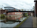
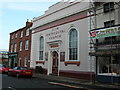

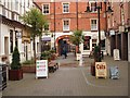
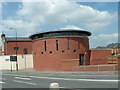
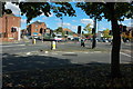
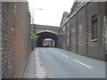
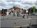
100 photos from this area
Area Information
Key information about the WR1 2SG including its size, population, and administrative classification.
- Area Type
- Postcode
- Area Size
- 7606 m²
- Population
- 1225
- Population Density
- 3451 people/km²
House Prices in WR1 2SG
90
Properties
£149,000
Average Sold Price
£68,000
Lowest Price
£230,000
Highest Price
Showing 90 properties
| Address | Type | Beds | Baths | Last Sale Price | Last Sale Date | |
|---|---|---|---|---|---|---|
| 30 Lowesmoor, Worcester, WR1 2SG | Unknown | - | - | £230,000 | Jan 2022 | |
| 26A Lowesmoor, Worcester, WR1 2SG | Flat | - | - | £68,000 | Nov 2002 | |
| Apartment 9, Boscobel Place, 36 Lowesmoor, Worcester, WR1 2SG | Flat | 1 | 1 | - | - | |
| 32A Lowesmoor, Worcester, WR1 2SG | Retail | - | - | - | - | |
| Flat B, 22 Lowesmoor, Worcester, WR1 2SG | Flat | - | - | - | - | |
| Block A Ground Floor, Rear Of 40 To 48, Lowesmoor, Worcester, WR1 2SG | undefined | - | - | - | - | |
| Block G First Floor, Rear Of 40 To 48, Lowesmoor, Worcester, WR1 2SG | undefined | - | - | - | - | |
| Block C First Floor, Rear Of 40 To 48, Lowesmoor, Worcester, WR1 2SG | undefined | - | - | - | - | |
| Block A First Floor, Rear Of 40 To 48, Lowesmoor, Worcester, WR1 2SG | undefined | - | - | - | - | |
| Block B First Floor, Rear Of 40 To 48, Lowesmoor, Worcester, WR1 2SG | undefined | - | - | - | - |
Page 1 of 9
Energy Efficiency in WR1 2SG
Amenities
Schools
| Rank | School | Type | Entry gender | Ages |
|---|
Explore more schools in this area
Go to Schools tabDemographics
Household Size
One person
most common
Accommodation Type
Flats
most common
Tenure
17
majority
Ethnic Group
White
most common
Religion
N/A
most common
Household Composition
N/A
most common
Age
47
median
Adults (30-64 years)
most common
Household Deprivation
N/A
with no deprivation
NS-SEC
25
in Lower managerial occupations
Explore more demographic insights in this area
Go to Demographics tabPlanning
Planning Constraints
- Flood RiskPremium
- Ramsar Wetland SitesPremium
- Area of Outstanding Natural BeautyPremium
- Protected Nature ReservePremium
- Protected WoodlandPremium