Area Overview for WR1 2ND
Photos of WR1 2ND
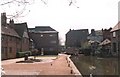
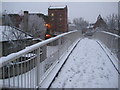
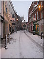
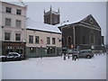
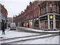
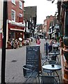
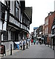
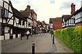

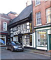
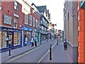
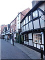
100 photos from this area
Area Information
Key information about the WR1 2ND including its size, population, and administrative classification.
- Area Type
- Postcode
- Area Size
- 1.8 hectares
- Population
- 1357
- Population Density
- 4312 people/km²
House Prices in WR1 2ND
29
Properties
£173,000
Average Sold Price
£100,000
Lowest Price
£250,000
Highest Price
Showing 29 properties
| Address | Type | Beds | Baths | Last Sale Price | Last Sale Date | |
|---|---|---|---|---|---|---|
| 14 Severn Street, Worcester, WR1 2ND | Terraced | 2 | 1 | £250,000 | May 2024 | |
| 18 Severn Street, Worcester, WR1 2ND | Terraced | 2 | 1 | £199,500 | Mar 2023 | |
| 20 Severn Street, Worcester, WR1 2ND | Terraced | 2 | 1 | £225,000 | Oct 2022 | |
| 16 Severn Street, Worcester, WR1 2ND | house | - | - | £175,000 | Dec 2020 | |
| 12 Severn Street, Worcester, WR1 2ND | Terraced | 2 | 1 | £160,000 | Sep 2020 | |
| 10 Severn Street, Worcester, WR1 2ND | Terraced | 2 | 1 | £162,500 | Mar 2020 | |
| 26 Severn Street, Worcester, WR1 2ND | house | 2 | 1 | £100,000 | Nov 2015 | |
| 24 Severn Street, Worcester, WR1 2ND | Terraced | 2 | 1 | £140,000 | Oct 2015 | |
| 28 Severn Street, Worcester, WR1 2ND | Terraced | 2 | 1 | £145,000 | Aug 2004 | |
| Dyson Perrins Museum Trust, Worcester Porcelain Museum, Severn Street, Worcester, WR1 2ND | Leisure | - | - | - | - |
Page 1 of 3
Energy Efficiency in WR1 2ND
Amenities
Schools
| Rank | School | Type | Entry gender | Ages |
|---|
Explore more schools in this area
Go to Schools tabDemographics
Household Size
One person
most common
Accommodation Type
Flats
most common
Tenure
28
majority
Ethnic Group
White
most common
Religion
N/A
most common
Household Composition
N/A
most common
Age
47
median
Adults (30-64 years)
most common
Household Deprivation
N/A
with no deprivation
NS-SEC
32
in Lower managerial occupations
Explore more demographic insights in this area
Go to Demographics tabPlanning
Planning Constraints
- Flood RiskPremium
- Ramsar Wetland SitesPremium
- Area of Outstanding Natural BeautyPremium
- Protected Nature ReservePremium
- Protected WoodlandPremium