Area Overview for WR1 1SP
Photos of WR1 1SP
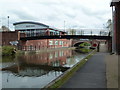
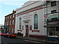
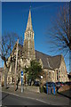
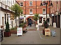
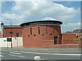
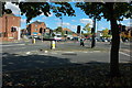
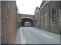
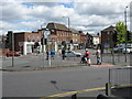
100 photos from this area
Area Information
Key information about the WR1 1SP including its size, population, and administrative classification.
- Area Type
- Postcode
- Area Size
- 2.3 hectares
- Population
- 1377
- Population Density
- 7036 people/km²
House Prices in WR1 1SP
32
Properties
£158,288
Average Sold Price
£43,500
Lowest Price
£305,000
Highest Price
Showing 32 properties
| Address | Type | Beds | Baths | Last Sale Price | Last Sale Date | |
|---|---|---|---|---|---|---|
| 67 Lansdowne Road, Worcester, WR1 1SP | Terraced | 3 | - | £235,000 | Sep 2024 | |
| 57 Lansdowne Road, Worcester, WR1 1SP | Terraced | 2 | 2 | £260,000 | Aug 2024 | |
| 45 Lansdowne Road, Worcester, WR1 1SP | Terraced | 3 | 2 | £265,000 | Apr 2024 | |
| 53 Lansdowne Road, Worcester, WR1 1SP | house | - | - | £305,000 | Oct 2022 | |
| 51A Lansdowne Road, Worcester, WR1 1SP | Bungalow | 2 | 1 | £200,000 | Dec 2019 | |
| 51C Lansdowne Road, Worcester, WR1 1SP | Terraced | 4 | 1 | £175,000 | Sep 2019 | |
| 75 Lansdowne Road, Worcester, WR1 1SP | Semi-detached | 3 | - | £235,000 | Jan 2019 | |
| 51B Lansdowne Road, Worcester, WR1 1SP | Semi-detached | 2 | - | £200,000 | Nov 2018 | |
| 77 Lansdowne Road, Worcester, WR1 1SP | house | 3 | - | £217,500 | Jun 2016 | |
| 63 Lansdowne Road, Worcester, WR1 1SP | Terraced | 3 | 2 | £144,000 | Jun 2016 |
Page 1 of 4
Energy Efficiency in WR1 1SP
Amenities
Schools
| Rank | School | Type | Entry gender | Ages |
|---|
Explore more schools in this area
Go to Schools tabDemographics
Household Size
Two person
most common
Accommodation Type
Houses
most common
Tenure
63
majority
Ethnic Group
White
most common
Religion
N/A
most common
Household Composition
N/A
most common
Age
47
median
Adults (30-64 years)
most common
Household Deprivation
N/A
with no deprivation
NS-SEC
37
in Lower managerial occupations
Explore more demographic insights in this area
Go to Demographics tabPlanning
Planning Constraints
- Flood RiskPremium
- Ramsar Wetland SitesPremium
- Area of Outstanding Natural BeautyPremium
- Protected Nature ReservePremium
- Protected WoodlandPremium