Area Overview for WR1 1JL
Photos of WR1 1JL
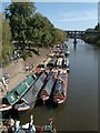
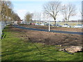
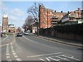
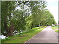
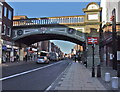

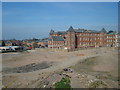
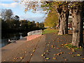
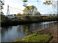
100 photos from this area
Area Information
Key information about the WR1 1JL including its size, population, and administrative classification.
- Area Type
- Postcode
- Area Size
- 3832 m²
- Population
- 1238
- Population Density
- 5022 people/km²
House Prices in WR1 1JL
47
Properties
£420,000
Average Sold Price
£405,000
Lowest Price
£435,000
Highest Price
Showing 47 properties
| Address | Type | Beds | Baths | Last Sale Price | Last Sale Date | |
|---|---|---|---|---|---|---|
| 25B The Tything, Worcester, WR1 1JL | Unknown | - | - | £435,000 | Nov 2021 | |
| Basement Flat, 35 The Tything, Worcester, WR1 1JL | Flat | - | - | £405,000 | Feb 2007 | |
| Flat 1, 28 The Tything, Worcester, WR1 1JL | Flat | 4 | 2 | - | - | |
| 25 The Tything, Worcester, WR1 1JL | Retail | 2 | 1 | - | - | |
| Flat B Rear Of, 35 The Tything, Worcester, WR1 1JL | Flat | - | - | - | - | |
| Former Flat 3, 27 The Tything, Worcester, WR1 1JL | undefined | - | - | - | - | |
| Former Flat 5, 27 The Tything, Worcester, WR1 1JL | undefined | - | - | - | - | |
| Former Flat 6, 27 The Tything, Worcester, WR1 1JL | Flat | - | - | - | - | |
| Former Flat 1, 27 The Tything, Worcester, WR1 1JL | Flat | - | - | - | - | |
| Former Flat 2, 27 The Tything, Worcester, WR1 1JL | Flat | 1 | - | - | - |
Page 1 of 5
Energy Efficiency in WR1 1JL
Amenities
Schools
| Rank | School | Type | Entry gender | Ages |
|---|
Explore more schools in this area
Go to Schools tabDemographics
Household Size
One person
most common
Accommodation Type
Flats
most common
Tenure
13
majority
Ethnic Group
White
most common
Religion
N/A
most common
Household Composition
N/A
most common
Age
22
median
Young Adults (15-29 years)
most common
Household Deprivation
N/A
with no deprivation
NS-SEC
19
in Lower managerial occupations
Explore more demographic insights in this area
Go to Demographics tabPlanning
Planning Constraints
- Flood RiskPremium
- Ramsar Wetland SitesPremium
- Area of Outstanding Natural BeautyPremium
- Protected Nature ReservePremium
- Protected WoodlandPremium