Area Overview for WR1 1AE
Photos of WR1 1AE


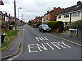
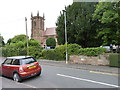
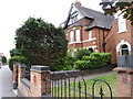
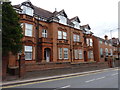
100 photos from this area
Area Information
Key information about the WR1 1AE including its size, population, and administrative classification.
- Area Type
- Postcode
- Area Size
- 1.6 hectares
- Population
- 2126
- Population Density
- 5367 people/km²
House Prices in WR1 1AE
39
Properties
£282,616
Average Sold Price
£225,000
Lowest Price
£355,000
Highest Price
Showing 39 properties
| Address | Type | Beds | Baths | Last Sale Price | Last Sale Date | |
|---|---|---|---|---|---|---|
| 37 The Lane, Worcester, WR1 1AE | Terraced | 4 | 3 | £325,000 | Jun 2025 | |
| 17 The Lane, Worcester, WR1 1AE | house | - | - | £285,000 | Feb 2023 | |
| 34 The Lane, Worcester, WR1 1AE | Terraced | 4 | - | £355,000 | Jun 2022 | |
| 1 The Lane, Worcester, WR1 1AE | Terraced | 4 | 1 | £325,000 | Jun 2021 | |
| 39 The Lane, Worcester, WR1 1AE | house | - | - | £235,000 | Nov 2020 | |
| 36 The Lane, Worcester, WR1 1AE | house | - | - | £280,250 | Oct 2020 | |
| 38 The Lane, Worcester, WR1 1AE | Terraced | 3 | - | £239,000 | Mar 2020 | |
| 7 The Lane, Worcester, WR1 1AE | Semi-detached | 4 | 2 | £295,000 | Jun 2019 | |
| 26 The Lane, Worcester, WR1 1AE | Terraced | 3 | - | £279,995 | Dec 2016 | |
| 30 The Lane, Worcester, WR1 1AE | house | - | - | £295,000 | Sep 2016 |
Page 1 of 4
Energy Efficiency in WR1 1AE
Amenities
Schools
| Rank | School | Type | Entry gender | Ages |
|---|
Explore more schools in this area
Go to Schools tabDemographics
Household Size
One person
most common
Accommodation Type
Houses
most common
Tenure
67
majority
Ethnic Group
White
most common
Religion
N/A
most common
Household Composition
N/A
most common
Age
47
median
Adults (30-64 years)
most common
Household Deprivation
N/A
with no deprivation
NS-SEC
40
in Lower managerial occupations
Explore more demographic insights in this area
Go to Demographics tabPlanning
Planning Constraints
- Flood RiskPremium
- Ramsar Wetland SitesPremium
- Area of Outstanding Natural BeautyPremium
- Protected Nature ReservePremium
- Protected WoodlandPremium