Area Overview for West Bromwich
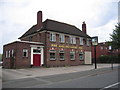
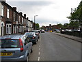
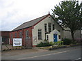
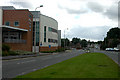
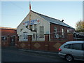
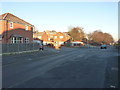
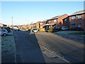
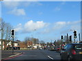
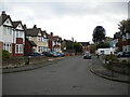
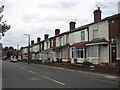
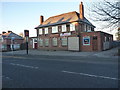
Photos of West Bromwich
Area Information
West Bromwich is a built-up area in England covering 22.2 km², home to 35,053 residents. With a population density of 1,579 people per square kilometre, it is a compact, densely populated town. The area’s character is shaped by its historical roots and modern infrastructure. Daily life here is influenced by its proximity to transport networks and retail hubs, offering a mix of practicality and community-centric living. While the median age of 70 suggests a predominantly older population, the town remains a hub for local amenities and services. West Bromwich is not a sprawling suburb but a focused urban space where residents navigate a balance between established neighbourhoods and evolving developments. Its appeal lies in accessibility—rail and metro links connect it to surrounding areas, while nearby shops and schools cater to everyday needs. For buyers, the area offers a blend of affordability and convenience, though the demographic profile indicates a community with specific needs and priorities.
- Area Type
- Built Up Area 250
- Area Size
- 22.2 km²
- Population
- 35053
- Population Density
- 1579 people/km²
West Bromwich’s lifestyle is shaped by its proximity to essential amenities. The retail sector includes major supermarkets like Morrisons Daily, Tesco Sandwell, and Lidl West, offering a range of groceries and daily necessities. Metro stops such as Black Lake and Dudley Street Guns Village provide easy access to local services, while rail stations like Tame Bridge Parkway and Bescot Stadium connect residents to nearby towns and cities. The area’s compact size means amenities are within practical reach, reducing the need for long commutes. Parks and leisure facilities are not explicitly mentioned, but the presence of multiple transport hubs suggests opportunities for recreation nearby. For residents, the balance of retail, transport, and connectivity fosters a convenient, community-focused way of life.
Amenities
Schools
West Bromwich is served by several schools, including primary institutions such as Hallam Junior School, Beeches Infant and Nursery School, Guns Village Junior School, and Guns Village Infant School. The Bridge Centre (KS4 Unit) is also listed, though its exact role is unspecified. The presence of multiple primary schools suggests a focus on early education, which may appeal to families with young children. However, the data does not include Ofsted ratings or performance metrics, so the quality of education cannot be assessed. The mix of schools indicates a range of options, but without additional details, it is unclear whether they cater to specific educational philosophies or special needs. Parents considering the area should investigate further to determine which schools align with their children’s requirements.
| Rank | A + A* % | School | Type | Entry gender | Ages |
|---|---|---|---|---|---|
| 1 | N/A | The Bridge Centre (KS4 Unit) | other | N/A | N/A |
| 2 | N/A | Hallam Junior School | primary | N/A | N/A |
| 3 | N/A | Beeches Infant and Nursery School | primary | N/A | N/A |
| 4 | N/A | Guns Village Junior School | primary | N/A | N/A |
| 5 | N/A | Guns Village Infant School | primary | N/A | N/A |
Explore more schools in this area
Go to Schools tabDemographics
West Bromwich’s population includes a median age of 70, reflecting a community skewed towards older adults. The most common age range is listed as “Total,” suggesting aggregated data rather than a breakdown of age groups. Home ownership stands at 56%, indicating a moderate mix of owner-occupied and rental properties. The household composition and accommodation types are reported as “Total,” meaning no detailed breakdown is available. The predominant ethnic group and religious affiliation are similarly listed as “Total,” so specific diversity metrics are absent. This lack of granularity means the area’s cultural and social composition cannot be precisely defined. However, the 56% home ownership rate suggests a stable, long-term resident base. The population density of 1,579 people per km² implies a compact, possibly older urban fabric where housing stock may include both traditional and modern properties.
Household Size
Accommodation Type
Tenure
Ethnic Group
Religion
Household Composition
Age
Household Deprivation
NS-SEC
Explore more demographic insights in this area
Go to Demographics tabPlanning
Planning Constraints
- Crime RiskLocked