Area Overview for Wellesbourne and Walton
Photos of Wellesbourne and Walton
Area Information
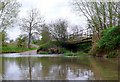
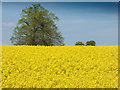
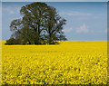
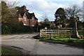
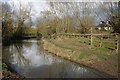
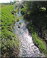
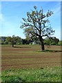
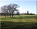
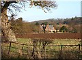
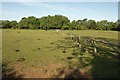
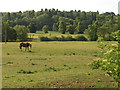
Wellesbourne and Walton is a civil parish in Warwickshire that stretches across 18.6 km². The area combines a rural village character with the history of a once-thriving estate. You live in a community split between two distinct centres: Chestnut Square and the Precinct. In 2021, the total population reached 7,283, though the current parish figure stands at 3,994 residents. Post-World War II development expanded the housing stock significantly, integrating new business spaces onto a former wartime airfield. The village retains its historic identity around the Dene Brook valley, yet modern amenities remain close by. Life here balances quiet countryside settings with practical village conveniences. The population density of 215 people per km² provides enough neighbours for a community feel without the congestion of urban suburbs. You will find that the area changed formally in 2014 when the parishes merged, but the local character reflects centuries of development. From the Iron Age, this land has hosted settlements, including the site of Walton with possible Roman habitation. The Welsh church was recorded in 862 AD, and medieval divisions once split the area into Mountford, Hastings, and Walton Mauduit. Today, the 19th-century Stags Head pub, a thatched drinking establishment since 1830, anchors the social scene. You are tracing a lineage that runs from Mercian parliaments to the agricultural labourers who organised the National Agricultural Labourers Union in 1872.
- Area Type
- Parish
- Area Size
- 18.6 km²
- Population
- 3994
- Population Density
- 215 people/km²
Demographics
The community in Wellesbourne and Walton is dominated by older residents. The median age is seventy years old, meaning you will find many retirees and mature families living here. While the specific age distribution is recorded as total, the high median suggests a quieter demographic profile than national averages. Sixty-nine per cent of households own their homes outright or with a mortgage. This high level of home ownership indicates stability and long-term residents who are invested in the local area. The vast majority of the 3,994 residents occupy these owned properties alongside rental accommodation within the parish. You will encounter a very settled population. The average household size remains consistent with rural patterns in the West Midlands region. The text does not specify ethnic religious breakdowns, but the longstanding nature of the village points to a homogenous community with deep local roots. The population density of 215 people per square kilometre creates an environment where neighbours know each other, yet streets remain spacious. This demographic profile means the schools and shops cater to all ages, though the older median age might influence local service priorities. The 2021 census recorded the peak population as 7,283, suggesting the parish holds potential for future demographic shifts or steady maintenance of current housing stock. You can expect a pace of life that prioritises comfort over rapid change.
Household Size
Accommodation Type
Tenure
Ethnic Group
Religion
Household Composition
Age
Household Deprivation
NS-SEC
Explore more demographic insights in this area
Go to Demographics tabPlanning
Planning Constraints
- Flood RiskLocked
- Ramsar Wetland SitesLocked
- Area of Outstanding Natural BeautyLocked
- Protected Nature ReserveLocked
- Protected WoodlandLocked
- Crime RiskLocked