Area Overview for Waterhouses
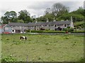
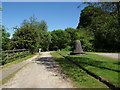
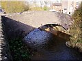
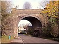
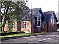
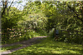
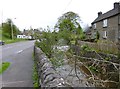
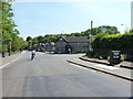
Photos of Waterhouses

Area Information
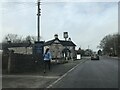
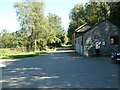
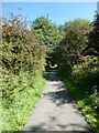
Waterhouses is a compact built-up area in England, covering 53.2 hectares. Its population is characterised by a median age of 70, suggesting a community skewed towards older residents. This area is home to a mix of housing types, with 81% of properties owner-occupied. Daily life here is shaped by proximity to essential amenities, including a metro station at Kingsley & Froghall and nearby retail outlets like Morrisons, Aldi, and Asda. The presence of three primary schools—Waterhouses CofE (VC) Primary School, Waterhouses CofE Middle School, and Waterhouses CofE Primary Academy—ensures families have multiple educational options. While the area’s small size means a tight-knit feel, it also means residents must travel slightly to access broader services. For those prioritising safety, the crime risk score of 83 indicates a below-average likelihood of incidents, reinforcing a sense of security. Living in Waterhouses offers a blend of practicality and community, though its limited digital connectivity may pose challenges for remote workers.
- Area Type
- Built Up Area 250
- Area Size
- 53.2 hectares
- Population
- Not available
- Population Density
- Not available
Living in Waterhouses offers access to a metro station at Kingsley & Froghall, providing links to regional transport. Nearby retail options include Morrisons, Aldi, and Asda, ensuring residents can shop for essentials without traveling far. The area’s compact size means amenities are closely clustered, though the lack of larger leisure facilities may require trips to nearby towns. The presence of three primary schools adds to the local character, fostering a community focused on education. While parks or green spaces are not explicitly mentioned, the proximity to retail and transport suggests a practical, service-oriented lifestyle. For those valuing convenience and a quiet, established community, Waterhouses provides a mix of necessity and simplicity.
Amenities
Schools
Waterhouses has three primary schools: Waterhouses CofE (VC) Primary School, Waterhouses CofE Middle School, and Waterhouses CofE Primary Academy. All are primary institutions, providing educational options for younger children. The presence of multiple schools suggests a focus on early education, though no Ofsted ratings are listed in the data. Families with children benefit from having several primary schools within the area, reducing the need for long commutes. The schools’ names imply a connection to the local church, which may influence the community’s social fabric. While the data does not specify academic performance, the availability of three primary schools ensures that children have access to multiple educational environments. This diversity of options is a key consideration for families prioritising schooling when choosing where to live.
| Rank | A + A* % | School | Type | Entry gender | Ages |
|---|---|---|---|---|---|
| 1 | N/A | Waterhouses CofE (VC) Primary School | primary | N/A | N/A |
| 2 | N/A | Waterhouses CofE Middle School | primary | N/A | N/A |
| 3 | N/A | Waterhouses CofE Primary Academy | primary | N/A | N/A |
Explore more schools in this area
Go to Schools tabDemographics
Waterhouses has a median age of 70, the highest in the dataset, indicating a predominantly older population. This demographic profile shapes the area’s character, with households likely to be couples or single occupants rather than larger families. Home ownership is high at 81%, suggesting stability and long-term residency. The data does not specify household composition or diversity, but the 81% ownership rate implies a community where property is largely held by residents rather than landlords. The absence of detailed figures on ethnic groups or religions means the area’s cultural makeup remains undefined. For those considering living in Waterhouses, the older demographic may influence local services and social dynamics. The area’s safety score of 83, categorised as low risk, aligns with the profile of a mature population, where crime rates are typically lower.
Household Size
Accommodation Type
Tenure
Ethnic Group
Religion
Household Composition
Age
Household Deprivation
NS-SEC
Explore more demographic insights in this area
Go to Demographics tabPlanning
Planning Constraints
- Crime RiskLocked