Area Overview for Sherbourne
Photos of Sherbourne


Area Information
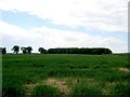
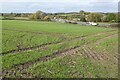
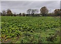
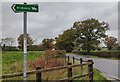
Living in Sherbourne means residing in a small, compact district where the layout prioritises local interaction over urban sprawl. This village and civil parish covers a modest 5.5 km², a size that keeps neighbours within easy walking distance of community facilities. You will find yourself situated in the Warwick district of Warwickshire, just three miles south of the town of Warwick itself. The area is administered jointly with Barford and Wasperton, creating a shared identity that links householders across these adjoining civil parishes. History defines the character of daily life in Sherbourne. The village was first recorded in the Domesday Book of 1086, long before the Victorian industrialisation that shaped much of England. The current landmark, All Saints Church, was designed by Sir George Gilbert Scott and consecrated in 1864. This Grade II* listed building features a memorial plaque to Maudsley of the Dambusters Raid, ensuring that local honour remains visible to all residents. When you walk through Sherbourne, you are moving through grounds that have evolved from a settlement of nine villagers and four slaves in 1086 to a modern community anchored by historic civic pride.
- Area Type
- Parish
- Area Size
- 5.5 km²
- Population
- Not available
- Population Density
- Not available
Demographics
The community in Sherbourne reflects a mature demographic profile. Evidence shows that the median age for residents is 70, indicating an area where life expectancy and retirement are dominant themes. Most households are composed of older age groups, which influences how community needs are met and how services are prioritised. You will encounter a population that has settled into a stable routine rather than one driven by rapid generational turnover. Home ownership is the defining characteristic of the local housing stock. Seventy-two per cent of households in Sherbourne own their homes outright or with a mortgage. This high rate of ownership suggests a community invested in its long-term stability rather than a transient rental market. The low percentage of private rented accommodation reinforces the idea that families here build roots over decades. When you consider living in Sherbourne, you are joining a group where property is a legacy for heirs and a permanent base rather than an investment vehicle.
Household Size
Accommodation Type
Tenure
Ethnic Group
Religion
Household Composition
Age
Household Deprivation
NS-SEC
Explore more demographic insights in this area
Go to Demographics tabPlanning
Planning Constraints
- Flood RiskPremium
- Ramsar Wetland SitesPremium
- Area of Outstanding Natural BeautyPremium
- Protected Nature ReservePremium
- Protected WoodlandPremium