Area Overview for Southam
Photos of Southam

Area Information
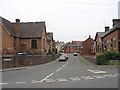
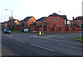
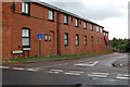
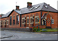
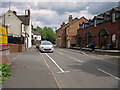
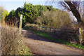
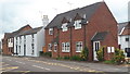
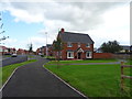
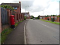
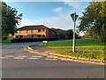
Southam is a historic market town situated within a civil parish covering 12.6 km² in Warwickshire, West Midlands. The area currently supports a population of 1,439, though historical records from the 2001 census noted a wider parish population of approximately 6,509. Recent estimates suggest around 2,490 residents for the core area, indicating a settled, likely year-round community. You are exploring a location defined by its deep historical roots, first mentioned as Sucham in the Domesday Book and formerly a Royal manor granted to Earl Leofwine. The town retains a quaint rural character along an ancient drover's route, anchored by a bustling market square and Grade I listed 14th-century parish church of St James. Daily life in Southam revolves around local heritage and countryside surroundings. Key landmarks include the early 16th-century Old Mint public house, Stoneythorpe Hall, and the Southam Heritage Collection. King Charles I used the town's mint to coin money during the Civil War, adding a layer of historical intrigue to the landscape. Sites such as Chesterton Windmill and the Holy Well further define the environment you would inhabit. While specific data on neighbourhood atmosphere is not available, the presence of these preserved structures and open countryside suggests a lifestyle focused on history and nature. If you are considering living in Southam, you will find a setting that balances ancient history with modern rural living.
- Area Type
- Parish
- Area Size
- 12.6 km²
- Population
- 1439
- Population Density
- 114 people/km²
Demographics
The community in Southam is characterised by a mature demographic profile with a median age of 70 years. This indicates a significant older population resides here, which often correlates with retirement communities or established families remaining in the town. With 71% of the area occupied by home owners, property ownership is the norm rather than the exception. This high level of ownership suggests a stable environment where long-term residents maintain their homes rather than moving frequently. The household composition and accommodation types are recorded as total categories in available data, meaning specific breakdowns of single-person versus family households are not explicitly detailed in the current figures. You will notice that the most common age range is listed as "Total", reflecting the broad spectrum within the resident population, yet the median age highlights the senior demographic preference. While ethnic diversity and religious demographics are noted as total categories without specific breakdowns, the high home ownership rate of 71% points to a self-contained community. Deprivation data is not explicitly provided in the current dataset, so you cannot assess income inequality based on these specific figures. However, the absence of protected nature reserves or Areas of Outstanding Natural Beauty means planning matters are generally straightforward compared to highly restricted zones. For those considering homes in Southam, the statistics suggest a quiet, owner-occupied environment dominated by older residents seeking stability.
Household Size
Accommodation Type
Tenure
Ethnic Group
Religion
Household Composition
Age
Household Deprivation
NS-SEC
Explore more demographic insights in this area
Go to Demographics tabPlanning
Planning Constraints
- Flood RiskPremium
- Ramsar Wetland SitesPremium
- Area of Outstanding Natural BeautyPremium
- Protected Nature ReservePremium
- Protected WoodlandPremium