Area Overview for Quinton
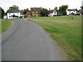
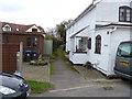
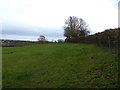
Photos of Quinton
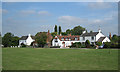
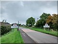
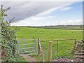
![Heart of England Way [4] in Quinton](https://images.propbar.co.uk/images/geograph/27/94/2794176_120.jpg)

Area Information
Living in Quinton offers a distinctive lifestyle within a civil parish that spans 12.4 square kilometres. This local area caters primarily to later-life residents and established families seeking a settled pace. The community benefits from strong digital infrastructure, which supports flexible working much better than older rural parishes. You will find reliable connectivity here, making it practical for those who work remotely or manage their home digitally. The location avoids significant environmental planning constraints, meaning there are no Ramsar wetland sites, Areas of Outstanding Natural Beauty, or protected nature reserves limiting development or views within the parish boundaries. Safety is a priority for new residents, with the area registering a low crime risk. Daily life involves navigating a neighbourhood where home ownership is the norm, reflecting a population that has put down roots over decades. This specific profile makes Quinton a focused choice for buyers who value quiet living without the complications of strict conservation areas or high‑risk flood zones. You can expect a straightforward environment where property values remain stable because the housing stock is largely owned by those who live there.
- Area Type
- Parish
- Area Size
- 12.4 km²
- Population
- Not available
- Population Density
- Not available
Demographics
The community in Quinton is defined by a mature age profile with a median age of 70 years. Most residents fall into the elderly demographic, which shapes the local demand for services and housing. Home ownership stands at 71 per cent, indicating that the majority of households own their properties outright or with a mortgage. This high level of ownership suggests a stable population rather than a transient rental market. Accommodation types reflect this long‑standing residency, with numerous single‑storey homes and adapted properties suitable for older adults. You will notice a neighbourhood where people have lived for generations, creating strong local ties. There are no planned interventions based on deprivation data because the current focus remains on managing an aging population effectively. The ethnic and religious diversity sections do not provide specific breakdowns, so the public record here highlights the broad demographic trend instead. However, the age structure alone explains why school enrollment numbers differ from younger towns. Families visiting schools near Quinton may find that the local primary schools serve a community with many children living with grandparents or in multi‑generational households.
Household Size
Accommodation Type
Tenure
Ethnic Group
Religion
Household Composition
Age
Household Deprivation
NS-SEC
Explore more demographic insights in this area
Go to Demographics tabPlanning
Planning Constraints
- Flood RiskPremium
- Ramsar Wetland SitesPremium
- Area of Outstanding Natural BeautyPremium
- Protected Nature ReservePremium
- Protected WoodlandPremium