Area Overview for Rugby
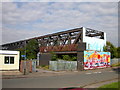
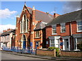
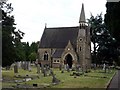
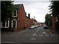
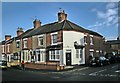
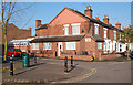
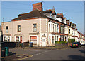
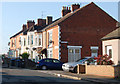
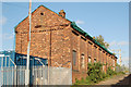
Photos of Rugby
Area Information
Rugby is a compact built-up area in England covering 22.9 km², home to 18,599 residents. With a population density of 812 people per square kilometre, it is a tightly knit community where daily life is shaped by proximity to local amenities. The area’s character is defined by its mix of residential properties and practical infrastructure, including Rugby Railway Station, which connects residents to surrounding regions. Retail options are abundant, with five notable stores including Co-op Rugby, Tesco Rugby, and Asda Rugby, ensuring convenience for shopping. Digital connectivity is strong, with a broadband score of 99 and mobile coverage scoring 85, supporting both remote work and everyday internet needs. Rugby’s appeal lies in its balance of accessibility and community cohesion, making it a viable choice for those seeking a well-connected, low-crime environment.
- Area Type
- Built Up Area 250
- Area Size
- 22.9 km²
- Population
- 18599
- Population Density
- 812 people/km²
Residents of Rugby have access to a variety of amenities within practical reach, including five retail outlets such as Co-op Rugby, Tesco Rugby, and Asda Rugby. These stores provide everyday essentials, reducing the need for long trips. The Rugby Railway Station offers connectivity to other areas, enhancing mobility for work or leisure. While the data does not mention parks or leisure facilities, the presence of multiple shops and transport links suggests a practical, convenience-focused lifestyle. The compact size of the area ensures that amenities are within walking or short driving distance, contributing to a manageable daily routine.
Amenities
Schools
Rugby offers a range of primary schools, including Hillmorton First School, Paddox First School, Newbold Glebe First School, and Newbold Avon Middle School, alongside the Eastern Area Pupil Referral Unit, which caters to specific educational needs. The absence of secondary schools in the data means families with older children may need to look beyond the immediate area for comprehensive education. The concentration of primary schools indicates a focus on early years education, which could be beneficial for families with young children. However, the lack of secondary school options may pose challenges for those planning long-term residency.
| Rank | A + A* % | School | Type | Entry gender | Ages |
|---|---|---|---|---|---|
| 1 | N/A | Eastern Area Pupil Referral Unit | other | N/A | N/A |
| 2 | N/A | Hillmorton First School | primary | N/A | N/A |
| 3 | N/A | Paddox First School | primary | N/A | N/A |
| 4 | N/A | Newbold Glebe First School | primary | N/A | N/A |
| 5 | N/A | Newbold Avon Middle School | primary | N/A | N/A |
Explore more schools in this area
Go to Schools tabDemographics
Rugby’s population has a median age of 70, indicating a community skewed toward older residents. Home ownership is high, with 68% of households owning their properties, suggesting stability and long-term residency. The data does not specify household composition or accommodation types, but the overall population density implies a mix of family and single-person households. While no detailed breakdown of ethnic or religious diversity is provided, the area’s demographics reflect a mature population profile. A median age this high may influence local services, with amenities tailored to older adults. This profile also means a lower proportion of young families compared to other areas, which could affect school demand and community dynamics.
Household Size
Accommodation Type
Tenure
Ethnic Group
Religion
Household Composition
Age
Household Deprivation
NS-SEC
Explore more demographic insights in this area
Go to Demographics tabPlanning
Planning Constraints
- Crime RiskLocked