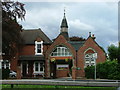
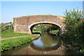
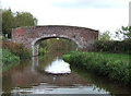
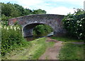
Area Overview for Walton Ward
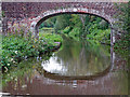
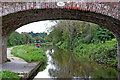
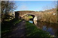
Photos of Walton Ward
Area Information
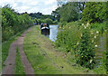
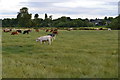
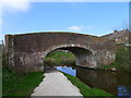
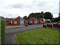
Walton Ward is a compact district within the unitary authority of Sefton, covering an area of just 3.5 square kilometres. This small footprint creates a closely knit environment where residents often know their neighbours personally. The ward sits near Sefton Coast, offering proximity to open spaces without the vast extension of a larger countryside district. Daily life here revolves around a static population that has settled in for the long term. You will find a community where routines are established and local events sustain social connections. The area feels purposeful rather than sprawling, which suits those who prefer a defined neighbourhood within a larger conurbation. Living in Walton Ward means experiencing a place built on stability. The limited size ensures that travel distances to local amenities remain short. Schools, parks, and shops are all within walking distance or a brief drive away. This concentration of services supports a lifestyle where you do not rely on long commutes for basic needs. The district caters to residents who value a settled pace of life over rapid expansion. You can walk to the edges of the ward and find river access or green spaces quickly. The character of the area remains consistent because infrastructure has not undergone recent large-scale redevelopment. This consistency offers predictability for residents who dislike the shock of change. The ward provides a clear physical identity distinct from neighbouring residential zones. Its boundary is well defined, helping you understand what constitutes this specific locale. Whether you drive through or take the bus, the layout remains recognisable. You will encounter familiar landmarks that have stood the test of time. This familiarity fosters a sense of security and belonging. The area does not try to reinvent itself but serves as a reliable home for its long-term inhabitants.
- Area Type
- District Borough Unitary Ward
- Area Size
- 3.5 km²
- Population
- Not available
- Population Density
- Not available
Demographics
The community profile of Walton Ward reflects a mature and settled population. The median age stands at 70 years old, marking this as a predominantly elderly neighbourhood. This demographic skew indicates that the area attracts retirees and older adults seeking quiet retirement living. Most residents fall into established age brackets rather than young families or transient workers. Approximately 77% of households own their homes outright, which is an exceptionally high figure compared to the national average. This level of home ownership signals deep financial stability and long-term roots within the ward. You will find very few tenants, as the rental sector plays a minor role in the local housing mix. The household composition aligns with older demographics, featuring fewer dependent children and more empty-nester families. Diversity in ethnicity and religious affiliation remains stable, matching the broader patterns of the immediate region without significant recent shifts. The lack of volatile population growth suggests a quiet, consistent social fabric. Residents here have likely lived near each other for decades, creating strong informal support networks. Deprivation data is not included for this specific ward in the current records. Consequently, you should rely on the high home ownership rate as a proxy for community wealth and stability. The absence of young families often correlates with lower transient poverty rates seen in student-heavy areas. Your daily interactions will likely involve neighbours of similar generation and socioeconomic background. This homogeneity reduces conflict over differing lifestyle expectations. Shopping habits, leisure choices, and community funding all reflect this senior-centric profile.
Household Size
Accommodation Type
Tenure
Ethnic Group
Religion
Household Composition
Age
Household Deprivation
NS-SEC
Explore more demographic insights in this area
Go to Demographics tabPlanning
Planning Constraints
- Flood RiskPremium
- Ramsar Wetland SitesPremium
- Area of Outstanding Natural BeautyPremium
- Protected Nature ReservePremium
- Protected WoodlandPremium
- Crime RiskPremium