Area Overview for Tupsley Ward
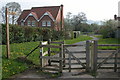
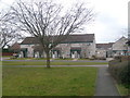
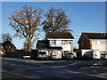
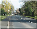
Photos of Tupsley Ward
Area Information
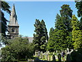
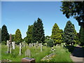
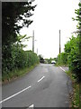
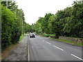
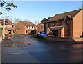
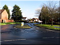
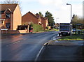
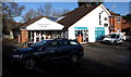
Tupsley Ward is a compact electoral ward situated within the unitary authority of Herefordshire, approximately two miles east of the city centre. This small district spans just 1.2 square kilometres, incorporating a network of residential streets, parks, and waterways. The area forms part of the Hereford and South Herefordshire constituency, offering residents a quiet environment close to the main urban hub while retaining a distinct local character. Historically, Tupsley functioned as a township-chapelry in Bishop-Hampton parish, a lineage recorded over a century ago with a population of 802 and significant property value. Modern boundaries were formally adjusted under the Herefordshire (Electoral Changes) Order 2014 to reflect current administrative needs. Living in Tupsley Ward means accessing local landmarks such as Tupsley School, Tupsley Bridge, and Hampton Dene directly from your doorstep. The proximity to Hereford railway station provides convenient access to wider travel networks without requiring a lengthy commute to leave the region. The ward includes notable features like The Knoll and a house mast, contributing to the visual landscape of this residential zone. Residents benefit from a layout that balances open spaces with built infrastructure. The area's history and its position within West Midlands keep it connected to broader regional developments while maintaining a manageable scale. For those seeking homes in Tupsley Ward, the location offers a blend of suburban convenience and proximity to urban amenities, making it a practical choice for families and individuals looking to settle near Hereford.
- Area Type
- District Borough Unitary Ward
- Area Size
- 1.2 km²
- Population
- Not available
- Population Density
- Not available
Demographics
The community profile in Tupsley Ward reflects a settled population, with a median age of 70 years. This metric indicates a demographic skew towards older residents, suggesting a neighbourhood where many have lived for an extended period. The most common age range recorded is simply listed as 'Total', reflecting the aggregated nature of the broader demographic data available for this ward. Residents are overwhelmingly free-owners rather than tenants, with home ownership standing at 80 percent of all households. This high rate of occupancy implies stability in the local community and a strong sense of rootedness among those living here. Household composition and accommodation type data are available but lack specific breakdowns beyond their presence in the dataset. The area does not report specific figures for predominant ethnic groups or religious affiliations in the provided records. However, the high ownership rate suggests that many families have invested their life savings into property within this ward. While specific statistics on household size are not detailed, the age profile implies that single-person households or married couples living alone form a significant portion of the population. The 1.2 square kilometre size of the ward means these residents live in a concentrated environment. Living in Tupsley Ward offers the benefit of a community where property ownership is the norm rather than the exception. This dynamic often fosters distinct local networks and a slower pace of life compared to areas with higher rental proportions.
Household Size
Accommodation Type
Tenure
Ethnic Group
Religion
Household Composition
Age
Household Deprivation
NS-SEC
Explore more demographic insights in this area
Go to Demographics tabPlanning
Planning Constraints
- Flood RiskPremium
- Ramsar Wetland SitesPremium
- Area of Outstanding Natural BeautyPremium
- Protected Nature ReservePremium
- Protected WoodlandPremium
- Crime RiskPremium