Area Overview for Tibberton and Cherrington
Photos of Tibberton and Cherrington

Area Information
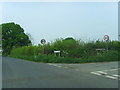
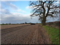
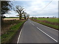
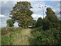
Living in Tibberton and Cherrington places you within a civil parish that spans 10.4 km² of land. This is a defined geographical area where daily life unfolds on a relatively small scale. You will find that the community is established and settled, characterised by a long-term resident population rather than transient arrivals. The layout supports a traditional rural pace, away from the density of major urban centres. Your experience here depends on the specific village settlement the house sits within, as the parish unit combines these distinct locations. There are no protected nature reserves or Areas of Outstanding Natural Beauty within the boundaries, meaning planning constraints related to high-level conservation are not a primary factor for new developments. Instead, the site is defined by its settlement status and size. You move into an environment where the character is shaped by the specific layout of homes and streets rather than overarching protected designations. The area presents a straightforward reality for buyers: a compact parish with established housing options and no designated wetland sites or high-level protected woodlands that would complicate structural changes.
- Area Type
- Parish
- Area Size
- 10.4 km²
- Population
- Not available
- Population Density
- Not available
Demographics
The community in Tibberton and Cherrington shows a clear demographic profile leaning towards older residents. The median age stands at 70, indicating that the population skews significantly senior compared to national averages. While the data aggregates ages under the label 'Age: Total', the high median confirms an older demographic dominance. You are likely to encounter a community where retirement or later-life living is a common experience. Household composition reflects this trend, moving away from young families towards smaller units or single-occupancy homes. Home ownership is exceptionally strong, with 76% of residents owning their properties outright. This figure suggests a market where people stay put after purchase, building long-term roots. The remaining 24% live in rented accommodation or other tenure types not captured in the ownership statistic. There are no specific breakdowns for accommodation types beyond the ownership split, nor detailed data on predominant ethnic groups or religious affiliations in the provided records. Despite the lack of fine-grained data, the 76% ownership rate points to a stable, owner-occupied neighbourhood where residents often value permanence over mobility.
Household Size
Accommodation Type
Tenure
Ethnic Group
Religion
Household Composition
Age
Household Deprivation
NS-SEC
Explore more demographic insights in this area
Go to Demographics tabPlanning
Planning Constraints
- Flood RiskPremium
- Ramsar Wetland SitesPremium
- Area of Outstanding Natural BeautyPremium
- Protected Nature ReservePremium
- Protected WoodlandPremium
- Crime RiskPremium