Area Overview for Three Crosses Ward
Photos of Three Crosses Ward

Area Information
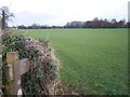
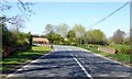
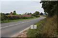
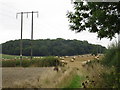
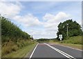
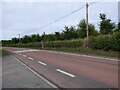
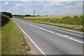
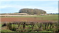
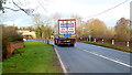
The Three Crosses Ward sits as an electoral district within the City of Birmingham, covering 105.1 square kilometres in the south west of the West Midlands. This area functions as a significant urban zone located to the west of the Northfield shopping centre. The ward was established in 2018 following boundary changes that expanded Birmingham's electoral divisions from 40 to 69. The new boundaries largely drew territory from the former Weoley ward, creating a district that encompasses a substantial stretch of the city. It lies firmly within the Birmingham Northfield constituency, which influences local governance and representation. The landscape here includes diverse housing stock and established neighbourhoods that form the fabric of daily life for residents. You are entering a mature urban environment where community life revolves around practical amenities and established transport routes. Understanding the specific history of this ward adds context to the current living experience. The area combines residential density with the structural history of recent administrative reorganisation.
- Area Type
- District Borough Unitary Ward
- Area Size
- 105.1 km²
- Population
- Not available
- Population Density
- Not available
Demographics
You will find that the community in Three Crosses Ward is older than the national average, with a median age of 70. The majority of households consist of residents in their older age brackets. Home ownership is high at 75 per cent of all properties. This statistic indicates a market dominated by owners rather than tenant households. Most residents live in standard residential accommodation types rather than specialized care facilities. The data does not provide specific breakdowns for predominant ethnic groups, religious affiliations, or detailed household compositions beyond the total figures available. You should approach demographic analysis with the understanding that these specific variables are not disclosed in current records. The high rate of home ownership suggests stability within the community. Families and retirees likely make up the core of the population given the age profile. The lack of specific diversity data means you cannot make assumptions about cultural composition without further local research. The 70-year median age is the primary demographic fact you can rely upon when assessing the social environment.
Household Size
Accommodation Type
Tenure
Ethnic Group
Religion
Household Composition
Age
Household Deprivation
NS-SEC
Explore more demographic insights in this area
Go to Demographics tabPlanning
Planning Constraints
- Flood RiskPremium
- Ramsar Wetland SitesPremium
- Area of Outstanding Natural BeautyPremium
- Protected Nature ReservePremium
- Protected WoodlandPremium
- Crime RiskPremium