Area Overview for TF9 2PW
Photos of TF9 2PW
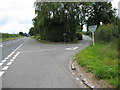
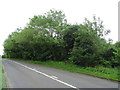
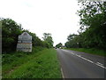
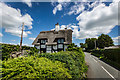
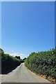
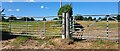
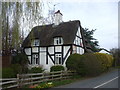
7 photos from this area
Area Information
Key information about the TF9 2PW including its size, population, and administrative classification.
- Area Type
- Postcode
- Area Size
- 56.7 hectares
- Population
- 1437
- Population Density
- 34 people/km²
House Prices in TF9 2PW
5
Properties
£262,500
Average Sold Price
£225,000
Lowest Price
£300,000
Highest Price
Showing 5 properties
| Address | Type | Beds | Baths | Last Sale Price | Last Sale Date | |
|---|---|---|---|---|---|---|
| Little Heath Green Cottage, Bog Lane, Almington, Newcastle Under Lyme, TF9 2PW | house | - | - | £225,000 | Jul 1998 | |
| Little Heath Green Farm, Bog Lane, Almington, Newcastle Under Lyme, TF9 2PW | house | 6 | 3 | £300,000 | Sep 1997 | |
| Tennis 50M From Little Heath Green Farm, Little Heath Green 92M From Unnamed Road, Bog Lane, Almington, Newcastle Under Lyme, TF9 2PW | Leisure | - | - | - | - | |
| Farm Buildings, Little Heath Green Farm, Bog Lane, Almington, Newcastle Under Lyme, TF9 2PW | Farm | - | - | - | - | |
| Cod Hall, Little Green Heath, Clod Hall Lane, Almington, Newcastle Under Lyme, TF9 2PW | Detached | - | - | - | - |
Energy Efficiency in TF9 2PW
Amenities
Schools
| Rank | School | Type | Entry gender | Ages |
|---|
Explore more schools in this area
Go to Schools tabDemographics
Household Size
Two person
most common
Accommodation Type
Houses
most common
Tenure
74
majority
Ethnic Group
White
most common
Religion
N/A
most common
Household Composition
N/A
most common
Age
47
median
Adults (30-64 years)
most common
Household Deprivation
N/A
with no deprivation
NS-SEC
37
in Lower managerial occupations
Explore more demographic insights in this area
Go to Demographics tabPlanning
Planning Constraints
- Flood RiskPremium
- Ramsar Wetland SitesPremium
- Area of Outstanding Natural BeautyPremium
- Protected Nature ReservePremium
- Protected WoodlandPremium