Area Overview for TF9 1JZ
Photos of TF9 1JZ

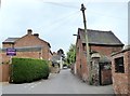
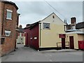
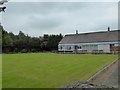
51 photos from this area
Area Information
Key information about the TF9 1JZ including its size, population, and administrative classification.
- Area Type
- Postcode
- Area Size
- 1.7 hectares
- Population
- 1518
- Population Density
- 1632 people/km²
House Prices in TF9 1JZ
27
Properties
£167,150
Average Sold Price
£60,000
Lowest Price
£265,000
Highest Price
Showing 27 properties
| Address | Type | Beds | Baths | Last Sale Price | Last Sale Date | |
|---|---|---|---|---|---|---|
| 80 Walkmill Road, Market Drayton, TF9 1JZ | Semi-detached | 3 | 1 | £176,000 | Apr 2024 | |
| 44 Walkmill Road, Market Drayton, TF9 1JZ | Semi-detached | 3 | 1 | £205,000 | Jan 2023 | |
| 46 Walkmill Road, Market Drayton, TF9 1JZ | Semi-detached | 3 | 1 | £265,000 | Aug 2022 | |
| 68 Walkmill Road, Market Drayton, TF9 1JZ | Semi-detached | 3 | 1 | £180,000 | Apr 2022 | |
| 78 Walkmill Road, Market Drayton, TF9 1JZ | house | - | - | £170,000 | May 2020 | |
| 72 Walkmill Road, Market Drayton, TF9 1JZ | Semi-detached | 3 | 1 | £158,500 | Sep 2019 | |
| 36 Walkmill Road, Market Drayton, TF9 1JZ | Semi-detached | 3 | 1 | £175,000 | Jul 2019 | |
| 66 Walkmill Road, Market Drayton, TF9 1JZ | Semi-detached | 3 | 1 | £167,000 | Feb 2017 | |
| 76 Walkmill Road, Market Drayton, TF9 1JZ | house | - | - | £60,000 | Dec 2011 | |
| 60 Walkmill Road, Market Drayton, TF9 1JZ | house | - | - | £115,000 | Jul 2009 |
Page 1 of 3
Energy Efficiency in TF9 1JZ
Amenities
Schools
| Rank | School | Type | Entry gender | Ages |
|---|
Explore more schools in this area
Go to Schools tabDemographics
Household Size
Two person
most common
Accommodation Type
Houses
most common
Tenure
73
majority
Ethnic Group
White
most common
Religion
N/A
most common
Household Composition
N/A
most common
Age
47
median
Adults (30-64 years)
most common
Household Deprivation
N/A
with no deprivation
NS-SEC
31
in Lower managerial occupations
Explore more demographic insights in this area
Go to Demographics tabPlanning
Planning Constraints
- Flood RiskPremium
- Ramsar Wetland SitesPremium
- Area of Outstanding Natural BeautyPremium
- Protected Nature ReservePremium
- Protected WoodlandPremium