Area Overview for TF7 4HF
Photos of TF7 4HF
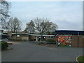
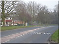
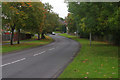
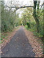
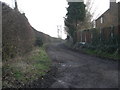
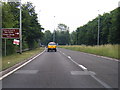

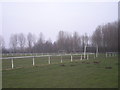


20 photos from this area
Area Information
Key information about the TF7 4HF including its size, population, and administrative classification.
- Area Type
- Postcode
- Area Size
- 1.5 hectares
- Population
- 1398
- Population Density
- 4481 people/km²
House Prices in TF7 4HF
58
Properties
£62,467
Average Sold Price
£23,500
Lowest Price
£90,000
Highest Price
Showing 58 properties
| Address | Type | Beds | Baths | Last Sale Price | Last Sale Date | |
|---|---|---|---|---|---|---|
| 80 Southgate, Sutton Hill, Telford, TF7 4HF | house | 3 | 1 | £90,000 | Dec 2023 | |
| 78 Southgate, Sutton Hill, Telford, TF7 4HF | Flat | - | - | £55,000 | Jul 2021 | |
| 81 Southgate, Sutton Hill, Telford, TF7 4HF | house | - | - | £80,000 | Mar 2021 | |
| 82 Southgate, Sutton Hill, Telford, TF7 4HF | house | - | - | £84,000 | Feb 2020 | |
| 70 Southgate, Sutton Hill, Telford, TF7 4HF | Terraced | 3 | 2 | £87,000 | Jan 2018 | |
| 77 Southgate, Sutton Hill, Telford, TF7 4HF | Flat | - | - | £50,000 | Aug 2016 | |
| 76 Southgate, Sutton Hill, Telford, TF7 4HF | Flat | - | - | £47,000 | Nov 2015 | |
| 71 Southgate, Sutton Hill, Telford, TF7 4HF | Terraced | 3 | 2 | £65,000 | Jul 2015 | |
| 94 Southgate, Sutton Hill, Telford, TF7 4HF | house | - | - | £80,625 | Oct 2009 | |
| 75 Southgate, Sutton Hill, Telford, TF7 4HF | Terraced | - | - | £73,950 | Aug 2004 |
Page 1 of 6
Energy Efficiency in TF7 4HF
Amenities
Schools
| Rank | School | Type | Entry gender | Ages |
|---|
Explore more schools in this area
Go to Schools tabDemographics
Household Size
Family (3-5 people)
most common
Accommodation Type
Houses
most common
Tenure
36
majority
Ethnic Group
White
most common
Religion
N/A
most common
Household Composition
N/A
most common
Age
22
median
Adults (30-64 years)
most common
Household Deprivation
N/A
with no deprivation
NS-SEC
11
in Lower managerial occupations
Explore more demographic insights in this area
Go to Demographics tabPlanning
Planning Constraints
- Flood RiskPremium
- Ramsar Wetland SitesPremium
- Area of Outstanding Natural BeautyPremium
- Protected Nature ReservePremium
- Protected WoodlandPremium