Area Overview for TF5 0DE
Photos of TF5 0DE
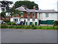
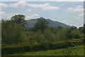
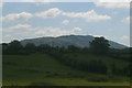
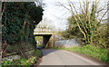
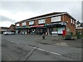
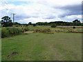
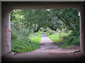
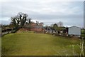
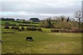
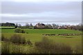
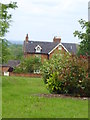
11 photos from this area
Area Information
Key information about the TF5 0DE including its size, population, and administrative classification.
- Area Type
- Postcode
- Area Size
- 18.0 hectares
- Population
- 2753
- Population Density
- 88 people/km²
House Prices in TF5 0DE
45
Properties
£326,619
Average Sold Price
£1,500
Lowest Price
£770,000
Highest Price
Showing 45 properties
| Address | Type | Beds | Baths | Last Sale Price | Last Sale Date | |
|---|---|---|---|---|---|---|
| 17 Donnerville Gardens, Admaston, Telford, TF5 0DE | Bungalow | 3 | 2 | £415,000 | Sep 2023 | |
| 11 Donnerville Gardens, Admaston, Telford, TF5 0DE | Bungalow | - | - | £392,000 | May 2022 | |
| 5 Donnerville Gardens, Admaston, Telford, TF5 0DE | Bungalow | 3 | 2 | £445,000 | Feb 2022 | |
| New Beginnings, 31 Donnerville Gardens, Admaston, Telford, TF5 0DE | house | - | - | £755,000 | Mar 2021 | |
| Puligny House, 29 Donnerville Gardens, Admaston, Telford, TF5 0DE | house | 6 | - | £770,000 | Feb 2020 | |
| 40 Donnerville Gardens, Admaston, Telford, TF5 0DE | Detached | 5 | 3 | £274,000 | May 2018 | |
| 10 Donnerville Gardens, Admaston, Telford, TF5 0DE | Bungalow | 3 | 2 | £325,000 | May 2018 | |
| 9 Donnerville Gardens, Admaston, Telford, TF5 0DE | Bungalow | 4 | 2 | £1,500 | Aug 2017 | |
| 4 Donnerville Gardens, Admaston, Telford, TF5 0DE | Detached | 5 | - | £340,000 | Nov 2016 | |
| 6 Donnerville Gardens, Admaston, Telford, TF5 0DE | Detached | 5 | 3 | £280,000 | Sep 2013 |
Page 1 of 5
Energy Efficiency in TF5 0DE
Amenities
Schools
| Rank | School | Type | Entry gender | Ages |
|---|
Explore more schools in this area
Go to Schools tabDemographics
Household Size
Two person
most common
Accommodation Type
Houses
most common
Tenure
75
majority
Ethnic Group
White
most common
Religion
N/A
most common
Household Composition
N/A
most common
Age
47
median
Adults (30-64 years)
most common
Household Deprivation
N/A
with no deprivation
NS-SEC
43
in Lower managerial occupations
Explore more demographic insights in this area
Go to Demographics tabPlanning
Planning Constraints
- Flood RiskPremium
- Ramsar Wetland SitesPremium
- Area of Outstanding Natural BeautyPremium
- Protected Nature ReservePremium
- Protected WoodlandPremium