Area Overview for TF5 0AS
Photos of TF5 0AS
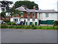
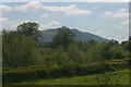
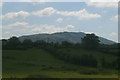
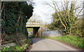
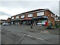
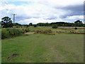
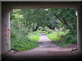
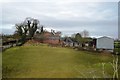
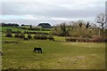
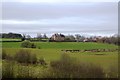

11 photos from this area
Area Information
Key information about the TF5 0AS including its size, population, and administrative classification.
- Area Type
- Postcode
- Area Size
- 9591 m²
- Population
- 1615
- Population Density
- 747 people/km²
House Prices in TF5 0AS
28
Properties
£136,602
Average Sold Price
£36,000
Lowest Price
£259,999
Highest Price
Showing 28 properties
| Address | Type | Beds | Baths | Last Sale Price | Last Sale Date | |
|---|---|---|---|---|---|---|
| 39 Broomfield Road, Admaston, Telford, TF5 0AS | Semi-detached | 3 | 1 | £150,000 | Jan 2025 | |
| 33 Broomfield Road, Admaston, Telford, TF5 0AS | house | 3 | 2 | £203,000 | Jun 2024 | |
| 37 Broomfield Road, Admaston, Telford, TF5 0AS | Retail | 3 | 1 | £259,999 | Oct 2022 | |
| 45 Broomfield Road, Admaston, Telford, TF5 0AS | Semi-detached | 3 | 1 | £170,000 | Jun 2021 | |
| 78 Broomfield Road, Admaston, Telford, TF5 0AS | Semi-detached | 2 | 1 | £130,000 | Jul 2018 | |
| 54 Broomfield Road, Admaston, Telford, TF5 0AS | Semi-detached | 3 | 2 | £163,000 | Feb 2018 | |
| 31 Broomfield Road, Admaston, Telford, TF5 0AS | Semi-detached | 3 | 2 | £155,000 | Feb 2018 | |
| 60 Broomfield Road, Admaston, Telford, TF5 0AS | Semi-detached | 3 | - | £158,000 | Mar 2017 | |
| 74 Broomfield Road, Admaston, Telford, TF5 0AS | Semi-detached | 3 | 1 | £135,000 | Nov 2015 | |
| 76 Broomfield Road, Admaston, Telford, TF5 0AS | Semi-detached | 2 | 2 | £140,000 | Aug 2015 |
Page 1 of 3
Energy Efficiency in TF5 0AS
Amenities
Schools
| Rank | School | Type | Entry gender | Ages |
|---|
Explore more schools in this area
Go to Schools tabDemographics
Household Size
Two person
most common
Accommodation Type
Houses
most common
Tenure
85
majority
Ethnic Group
White
most common
Religion
N/A
most common
Household Composition
N/A
most common
Age
47
median
Adults (30-64 years)
most common
Household Deprivation
N/A
with no deprivation
NS-SEC
39
in Lower managerial occupations
Explore more demographic insights in this area
Go to Demographics tabPlanning
Planning Constraints
- Flood RiskPremium
- Ramsar Wetland SitesPremium
- Area of Outstanding Natural BeautyPremium
- Protected Nature ReservePremium
- Protected WoodlandPremium