Area Overview for TF4 3TS
Photos of TF4 3TS
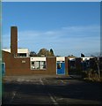
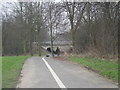
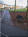
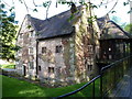

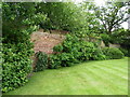
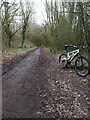
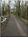
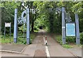
50 photos from this area
Area Information
Key information about the TF4 3TS including its size, population, and administrative classification.
- Area Type
- Postcode
- Area Size
- 1.2 hectares
- Population
- 1539
- Population Density
- 3156 people/km²
House Prices in TF4 3TS
31
Properties
£105,188
Average Sold Price
£35,815
Lowest Price
£167,500
Highest Price
Showing 31 properties
| Address | Type | Beds | Baths | Last Sale Price | Last Sale Date | |
|---|---|---|---|---|---|---|
| 24 Magpie Way, Aqueduct, Telford, TF4 3TS | Semi-detached | 2 | 1 | £160,000 | Oct 2025 | |
| 23 Magpie Way, Aqueduct, Telford, TF4 3TS | Semi-detached | 2 | 1 | £167,500 | Mar 2025 | |
| 11 Magpie Way, Aqueduct, Telford, TF4 3TS | Semi-detached | 2 | 1 | £135,000 | Mar 2025 | |
| 16 Magpie Way, Aqueduct, Telford, TF4 3TS | Semi-detached | 2 | 1 | £150,000 | May 2024 | |
| 22 Magpie Way, Aqueduct, Telford, TF4 3TS | Semi-detached | 2 | 1 | £155,000 | Aug 2023 | |
| 25 Magpie Way, Aqueduct, Telford, TF4 3TS | Semi-detached | 2 | 1 | £165,000 | Apr 2023 | |
| 3 Magpie Way, Aqueduct, Telford, TF4 3TS | Semi-detached | 2 | 1 | £150,000 | Nov 2022 | |
| 1 Magpie Way, Aqueduct, Telford, TF4 3TS | Retail | 2 | 1 | £158,000 | Apr 2022 | |
| 5 Magpie Way, Aqueduct, Telford, TF4 3TS | Semi-detached | 2 | 1 | £120,000 | Apr 2021 | |
| 26 Magpie Way, Aqueduct, Telford, TF4 3TS | Semi-detached | 3 | 1 | £142,000 | Oct 2019 |
Page 1 of 4
Energy Efficiency in TF4 3TS
Amenities
Schools
| Rank | School | Type | Entry gender | Ages |
|---|
Explore more schools in this area
Go to Schools tabDemographics
Household Size
One person
most common
Accommodation Type
Houses
most common
Tenure
52
majority
Ethnic Group
White
most common
Religion
N/A
most common
Household Composition
N/A
most common
Age
47
median
Adults (30-64 years)
most common
Household Deprivation
N/A
with no deprivation
NS-SEC
22
in Lower managerial occupations
Explore more demographic insights in this area
Go to Demographics tabPlanning
Planning Constraints
- Flood RiskPremium
- Ramsar Wetland SitesPremium
- Area of Outstanding Natural BeautyPremium
- Protected Nature ReservePremium
- Protected WoodlandPremium