Area Overview for TF4 2QG
Photos of TF4 2QG
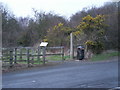
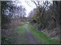

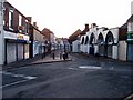


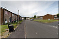


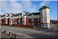


46 photos from this area
Area Information
Key information about the TF4 2QG including its size, population, and administrative classification.
- Area Type
- Postcode
- Area Size
- 1.1 hectares
- Population
- 1545
- Population Density
- 2537 people/km²
House Prices in TF4 2QG
31
Properties
£77,367
Average Sold Price
£27,950
Lowest Price
£140,000
Highest Price
Showing 31 properties
| Address | Type | Beds | Baths | Last Sale Price | Last Sale Date | |
|---|---|---|---|---|---|---|
| 30 Chiltern Gardens, Dawley, Telford, TF4 2QG | Flat | 2 | 1 | £85,000 | Sep 2025 | |
| 22 Chiltern Gardens, Dawley, Telford, TF4 2QG | Semi-detached | 2 | 2 | £123,000 | Apr 2025 | |
| 29 Chiltern Gardens, Dawley, Telford, TF4 2QG | Terraced | 4 | - | £122,000 | Apr 2025 | |
| 8 Chiltern Gardens, Dawley, Telford, TF4 2QG | Terraced | 3 | 1 | £140,000 | Oct 2024 | |
| 21 Chiltern Gardens, Dawley, Telford, TF4 2QG | Terraced | 2 | 1 | £68,500 | Apr 2024 | |
| 19 Chiltern Gardens, Dawley, Telford, TF4 2QG | Terraced | 2 | 1 | £105,000 | Mar 2023 | |
| 25 Chiltern Gardens, Dawley, Telford, TF4 2QG | Terraced | 3 | 1 | £83,000 | Aug 2021 | |
| 27 Chiltern Gardens, Dawley, Telford, TF4 2QG | Terraced | 2 | 1 | £76,500 | Jul 2021 | |
| 26 Chiltern Gardens, Dawley, Telford, TF4 2QG | Terraced | 3 | 1 | £60,000 | Apr 2019 | |
| 23 Chiltern Gardens, Dawley, Telford, TF4 2QG | Terraced | 3 | 1 | £107,000 | Feb 2019 |
Page 1 of 4
Energy Efficiency in TF4 2QG
Amenities
Schools
| Rank | School | Type | Entry gender | Ages |
|---|
Explore more schools in this area
Go to Schools tabDemographics
Household Size
One person
most common
Accommodation Type
Houses
most common
Tenure
41
majority
Ethnic Group
White
most common
Religion
N/A
most common
Household Composition
N/A
most common
Age
47
median
Adults (30-64 years)
most common
Household Deprivation
N/A
with no deprivation
NS-SEC
18
in Lower managerial occupations
Explore more demographic insights in this area
Go to Demographics tabPlanning
Planning Constraints
- Flood RiskPremium
- Ramsar Wetland SitesPremium
- Area of Outstanding Natural BeautyPremium
- Protected Nature ReservePremium
- Protected WoodlandPremium