Area Overview for TF2 9TH
Photos of TF2 9TH


78 photos from this area
Area Information
Key information about the TF2 9TH including its size, population, and administrative classification.
- Area Type
- Postcode
- Area Size
- 36.5 hectares
- Population
- 1521
- Population Density
- 43 people/km²
House Prices in TF2 9TH
73
Properties
£316,991
Average Sold Price
£187,983
Lowest Price
£412,995
Highest Price
Showing 73 properties
| Address | Type | Beds | Baths | Last Sale Price | Last Sale Date | |
|---|---|---|---|---|---|---|
| 121 George Wynn Way, Priorslee, Telford, TF2 9TH | Semi-detached | 2 | - | £410,000 | May 2024 | |
| 117 George Wynn Way, Priorslee, Telford, TF2 9TH | Detached | 3 | - | £395,000 | Jan 2024 | |
| 119 George Wynn Way, Priorslee, Telford, TF2 9TH | Detached | 4 | - | £404,995 | Sep 2023 | |
| 111 George Wynn Way, Priorslee, Telford, TF2 9TH | house | - | - | £379,000 | Sep 2023 | |
| 107 George Wynn Way, Priorslee, Telford, TF2 9TH | Detached | 4 | - | £359,995 | Sep 2023 | |
| 113 George Wynn Way, Priorslee, Telford, TF2 9TH | house | - | - | £359,995 | Aug 2023 | |
| 115 George Wynn Way, Priorslee, Telford, TF2 9TH | Semi-detached | 3 | - | £374,995 | Jul 2023 | |
| 93 George Wynn Way, Priorslee, Telford, TF2 9TH | Semi-detached | 3 | - | £309,995 | May 2023 | |
| 95 George Wynn Way, Priorslee, Telford, TF2 9TH | Detached | 3 | 2 | £304,995 | May 2023 | |
| 77 George Wynn Way, Priorslee, Telford, TF2 9TH | Detached | 3 | 2 | £229,995 | Mar 2023 |
Page 1 of 8
Energy Efficiency in TF2 9TH
Amenities
Schools
| Rank | School | Type | Entry gender | Ages |
|---|
Explore more schools in this area
Go to Schools tabDemographics
Household Size
Family (3-5 people)
most common
Accommodation Type
Houses
most common
Tenure
76
majority
Ethnic Group
White
most common
Religion
N/A
most common
Household Composition
N/A
most common
Age
47
median
Adults (30-64 years)
most common
Household Deprivation
N/A
with no deprivation
NS-SEC
48
in Lower managerial occupations
Explore more demographic insights in this area
Go to Demographics tabPlanning
Planning Constraints
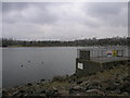
- Flood RiskPremium
- Ramsar Wetland SitesPremium
- Area of Outstanding Natural BeautyPremium
- Protected Nature ReservePremium
- Protected WoodlandPremium