Area Overview for TF2 8TB
Photos of TF2 8TB

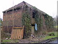
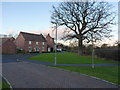
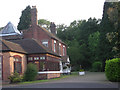
12 photos from this area
Area Information
Key information about the TF2 8TB including its size, population, and administrative classification.
- Area Type
- Postcode
- Area Size
- 2.6 hectares
- Population
- 2186
- Population Density
- 319 people/km²
House Prices in TF2 8TB
38
Properties
£211,616
Average Sold Price
£112,000
Lowest Price
£335,000
Highest Price
Showing 38 properties
| Address | Type | Beds | Baths | Last Sale Price | Last Sale Date | |
|---|---|---|---|---|---|---|
| 19 Farr Lane, Muxton, Telford, TF2 8TB | Detached | 4 | 2 | £335,000 | May 2025 | |
| 2 Farr Lane, Muxton, Telford, TF2 8TB | Terraced | 4 | 2 | £249,950 | Mar 2025 | |
| 5 Farr Lane, Muxton, Telford, TF2 8TB | Terraced | 3 | 2 | £249,950 | Nov 2024 | |
| 24 Farr Lane, Muxton, Telford, TF2 8TB | Detached | 3 | 2 | £283,500 | Apr 2023 | |
| 1 Farr Lane, Muxton, Telford, TF2 8TB | Semi-detached | 3 | - | £256,050 | Jul 2022 | |
| 37 Farr Lane, Muxton, Telford, TF2 8TB | Detached | 3 | 2 | £230,000 | Sep 2021 | |
| 33 Farr Lane, Muxton, Telford, TF2 8TB | house | 3 | 2 | £195,000 | Feb 2021 | |
| 22 Farr Lane, Muxton, Telford, TF2 8TB | Detached | 4 | 2 | £240,000 | May 2019 | |
| 38 Farr Lane, Muxton, Telford, TF2 8TB | Detached | 4 | 2 | £265,000 | Apr 2019 | |
| 30 Farr Lane, Muxton, Telford, TF2 8TB | Terraced | 4 | 2 | £184,000 | Oct 2017 |
Page 1 of 4
Energy Efficiency in TF2 8TB
Amenities
Schools
| Rank | School | Type | Entry gender | Ages |
|---|
Explore more schools in this area
Go to Schools tabDemographics
Household Size
Family (3-5 people)
most common
Accommodation Type
Houses
most common
Tenure
73
majority
Ethnic Group
White
most common
Religion
N/A
most common
Household Composition
N/A
most common
Age
47
median
Adults (30-64 years)
most common
Household Deprivation
N/A
with no deprivation
NS-SEC
40
in Lower managerial occupations
Explore more demographic insights in this area
Go to Demographics tabPlanning
Planning Constraints
- Flood RiskPremium
- Ramsar Wetland SitesPremium
- Area of Outstanding Natural BeautyPremium
- Protected Nature ReservePremium
- Protected WoodlandPremium