Area Overview for TF2 6DH
Photos of TF2 6DH
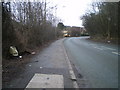
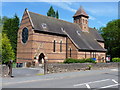

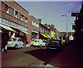
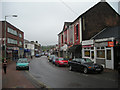
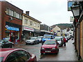
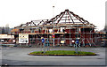
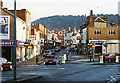
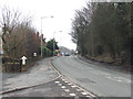
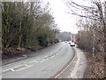
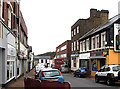
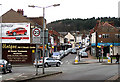
100 photos from this area
Area Information
Key information about the TF2 6DH including its size, population, and administrative classification.
- Area Type
- Postcode
- Area Size
- 2.8 hectares
- Population
- 1924
- Population Density
- 2647 people/km²
House Prices in TF2 6DH
23
Properties
£237,368
Average Sold Price
£74,000
Lowest Price
£400,000
Highest Price
Showing 23 properties
| Address | Type | Beds | Baths | Last Sale Price | Last Sale Date | |
|---|---|---|---|---|---|---|
| West View, Station Fields, Oakengates, Telford, TF2 6DH | Detached | - | - | £260,000 | Sep 2021 | |
| The Paddocks, Station Fields, Oakengates, Telford, TF2 6DH | Detached | 6 | 4 | £400,000 | Apr 2021 | |
| Sutherland House, Station Fields, Oakengates, Telford, TF2 6DH | Detached | 3 | 1 | £225,000 | Apr 2020 | |
| The Squirrels, Station Fields, Oakengates, Telford, TF2 6DH | Detached | 4 | 3 | £294,950 | Apr 2020 | |
| Leystone, Station Fields, Oakengates, Telford, TF2 6DH | Bungalow | 2 | 1 | £200,000 | Feb 2020 | |
| Florace, Station Fields, Oakengates, Telford, TF2 6DH | Detached | 3 | - | £260,000 | Dec 2017 | |
| Cartref, Station Fields, Oakengates, Telford, TF2 6DH | Detached | 4 | 1 | £265,000 | Aug 2017 | |
| Field House, Station Fields, Oakengates, Telford, TF2 6DH | Detached | 3 | 1 | £249,995 | Apr 2016 | |
| Coronation Bungalow, Station Fields, Oakengates, Telford, TF2 6DH | Detached | 3 | 2 | £285,000 | Nov 2015 | |
| Chelston, Station Fields, Oakengates, Telford, TF2 6DH | Semi-detached | 3 | 2 | £185,000 | Aug 2007 |
Page 1 of 3
Energy Efficiency in TF2 6DH
Amenities
Schools
| Rank | School | Type | Entry gender | Ages |
|---|
Explore more schools in this area
Go to Schools tabDemographics
Household Size
One person
most common
Accommodation Type
Houses
most common
Tenure
54
majority
Ethnic Group
White
most common
Religion
N/A
most common
Household Composition
N/A
most common
Age
47
median
Adults (30-64 years)
most common
Household Deprivation
N/A
with no deprivation
NS-SEC
25
in Lower managerial occupations
Explore more demographic insights in this area
Go to Demographics tabPlanning
Planning Constraints
- Flood RiskPremium
- Ramsar Wetland SitesPremium
- Area of Outstanding Natural BeautyPremium
- Protected Nature ReservePremium
- Protected WoodlandPremium