Area Overview for TF2 6BU
Photos of TF2 6BU
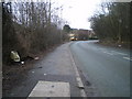
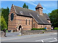


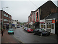
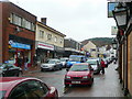

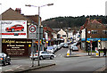
100 photos from this area
Area Information
Key information about the TF2 6BU including its size, population, and administrative classification.
- Area Type
- Postcode
- Area Size
- 1.5 hectares
- Population
- 1924
- Population Density
- 2647 people/km²
House Prices in TF2 6BU
29
Properties
£106,500
Average Sold Price
£35,250
Lowest Price
£152,500
Highest Price
Showing 29 properties
| Address | Type | Beds | Baths | Last Sale Price | Last Sale Date | |
|---|---|---|---|---|---|---|
| 23 Church Street, Oakengates, Telford, TF2 6BU | Semi-detached | 2 | 1 | £152,500 | Feb 2024 | |
| 18 Church Street, Oakengates, Telford, TF2 6BU | Semi-detached | 3 | 1 | £148,000 | Mar 2019 | |
| 17 Church Street, Oakengates, Telford, TF2 6BU | Semi-detached | 3 | 1 | £134,000 | Dec 2017 | |
| 13 Church Street, Oakengates, Telford, TF2 6BU | Semi-detached | 1 | - | £130,000 | Nov 2017 | |
| 19 Church Street, Oakengates, Telford, TF2 6BU | Semi-detached | 3 | 1 | £135,000 | Mar 2017 | |
| 15 Church Street, Oakengates, Telford, TF2 6BU | Detached | 3 | 1 | £125,000 | May 2016 | |
| 8A Church Street, Oakengates, Telford, TF2 6BU | house | - | - | £90,000 | Jan 2015 | |
| 6A Church Street, Oakengates, Telford, TF2 6BU | Semi-detached | 3 | 1 | £62,500 | Nov 2014 | |
| 20 Church Street, Oakengates, Telford, TF2 6BU | house | - | - | £97,000 | Sep 2010 | |
| 14 Church Street, Oakengates, Telford, TF2 6BU | house | - | - | £117,750 | Nov 2007 |
Page 1 of 3
Energy Efficiency in TF2 6BU
Amenities
Schools
| Rank | School | Type | Entry gender | Ages |
|---|
Explore more schools in this area
Go to Schools tabDemographics
Household Size
One person
most common
Accommodation Type
Houses
most common
Tenure
54
majority
Ethnic Group
White
most common
Religion
N/A
most common
Household Composition
N/A
most common
Age
47
median
Adults (30-64 years)
most common
Household Deprivation
N/A
with no deprivation
NS-SEC
25
in Lower managerial occupations
Explore more demographic insights in this area
Go to Demographics tabPlanning
Planning Constraints
- Flood RiskPremium
- Ramsar Wetland SitesPremium
- Area of Outstanding Natural BeautyPremium
- Protected Nature ReservePremium
- Protected WoodlandPremium