Area Overview for TF2 0AA
Photos of TF2 0AA
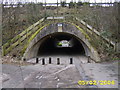
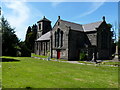

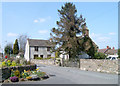
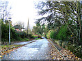

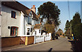
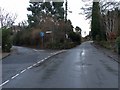
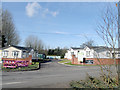
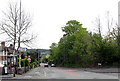
83 photos from this area
Area Information
Key information about the TF2 0AA including its size, population, and administrative classification.
- Area Type
- Postcode
- Area Size
- 1.8 hectares
- Population
- 1924
- Population Density
- 2647 people/km²
House Prices in TF2 0AA
20
Properties
£239,000
Average Sold Price
£83,000
Lowest Price
£540,000
Highest Price
Showing 20 properties
| Address | Type | Beds | Baths | Last Sale Price | Last Sale Date | |
|---|---|---|---|---|---|---|
| Sunny Bungalow, Sunnyside Road, Ketley Bank, Telford, TF2 0AA | Bungalow | 2 | 1 | £230,000 | Aug 2025 | |
| Woodland House, Sunnyside Road, Ketley Bank, Telford, TF2 0AA | Detached | 4 | 4 | £540,000 | Mar 2025 | |
| Oakview Bungalow, Sunnyside Road, Ketley Bank, Telford, TF2 0AA | Detached | - | - | £212,500 | Mar 2022 | |
| Orchard House, Sunnyside Road, Ketley Bank, Telford, TF2 0AA | house | - | - | £270,000 | Feb 2021 | |
| Holly House, Sunnyside Road, Ketley Bank, Telford, TF2 0AA | Detached | 3 | 2 | £245,000 | Dec 2020 | |
| The White Cottage, Sunnyside Road, Ketley Bank, Telford, TF2 0AA | Detached | - | - | £187,500 | Jan 2019 | |
| The Croft, Sunnyside Road, Ketley Bank, Telford, TF2 0AA | house | - | - | £144,000 | Jul 2013 | |
| Fernville, Sunnyside Road, Ketley Bank, Telford, TF2 0AA | Detached | 2 | 2 | £83,000 | May 2001 | |
| Mobile Home, Woodland House, Sunnyside Road, Ketley Bank, Telford, TF2 0AA | Land | - | - | - | - | |
| Flat, Rose And Crown, Sunnyside Road, Ketley Bank, Telford, TF2 0AA | Flat | - | - | - | - |
Page 1 of 2
Energy Efficiency in TF2 0AA
Amenities
Schools
| Rank | School | Type | Entry gender | Ages |
|---|
Explore more schools in this area
Go to Schools tabDemographics
Household Size
One person
most common
Accommodation Type
Houses
most common
Tenure
54
majority
Ethnic Group
White
most common
Religion
N/A
most common
Household Composition
N/A
most common
Age
47
median
Adults (30-64 years)
most common
Household Deprivation
N/A
with no deprivation
NS-SEC
25
in Lower managerial occupations
Explore more demographic insights in this area
Go to Demographics tabPlanning
Planning Constraints
- Flood RiskPremium
- Ramsar Wetland SitesPremium
- Area of Outstanding Natural BeautyPremium
- Protected Nature ReservePremium
- Protected WoodlandPremium