Area Overview for TF12 5QT
Photos of TF12 5QT
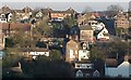
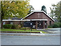
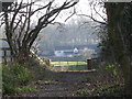
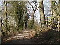
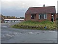
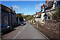
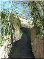
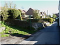
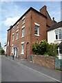
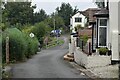
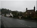
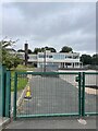
26 photos from this area
Area Information
Key information about the TF12 5QT including its size, population, and administrative classification.
- Area Type
- Postcode
- Area Size
- 1.0 hectares
- Population
- 1422
- Population Density
- 1186 people/km²
House Prices in TF12 5QT
12
Properties
£211,999
Average Sold Price
£150,000
Lowest Price
£350,000
Highest Price
Showing 12 properties
| Address | Type | Beds | Baths | Last Sale Price | Last Sale Date | |
|---|---|---|---|---|---|---|
| Islay, Bridge Road, Benthall, Broseley, TF12 5QT | Bungalow | 2 | 1 | £230,000 | May 2023 | |
| 63 Bridge Road, Benthall, Broseley, TF12 5QT | Cottage | 1 | 1 | £350,000 | Sep 2018 | |
| 61 Bridge Road, Benthall, Broseley, TF12 5QT | Detached | - | - | £150,000 | Aug 2018 | |
| Fernleigh, Bridge Road, Benthall, Broseley, TF12 5QT | Semi-detached | 4 | 1 | £192,000 | May 2012 | |
| Ael Y Bryn, 60 Bridge Road, Benthall, Broseley, TF12 5QT | Bungalow | - | - | £195,000 | Nov 2010 | |
| 6 Bridge Road, Benthall, Broseley, TF12 5QT | house | 3 | 1 | £154,995 | Nov 2003 | |
| Kings View, Bridge Road, Benthall, Broseley, TF12 5QT | Land | 3 | 2 | - | - | |
| 3 Bridge Road, Benthall, Broseley, TF12 5QT | Semi-detached | 3 | 1 | - | - | |
| 62 Bridge Road, Benthall, Broseley, TF12 5QT | house | - | - | - | - | |
| Meri Khet, Bridge Road, Benthall, Broseley, TF12 5QT | house | - | - | - | - |
Page 1 of 2
Energy Efficiency in TF12 5QT
Amenities
Schools
| Rank | School | Type | Entry gender | Ages |
|---|
Explore more schools in this area
Go to Schools tabDemographics
Household Size
Two person
most common
Accommodation Type
Houses
most common
Tenure
81
majority
Ethnic Group
White
most common
Religion
N/A
most common
Household Composition
N/A
most common
Age
47
median
Adults (30-64 years)
most common
Household Deprivation
N/A
with no deprivation
NS-SEC
34
in Lower managerial occupations
Explore more demographic insights in this area
Go to Demographics tabPlanning
Planning Constraints
- Flood RiskPremium
- Ramsar Wetland SitesPremium
- Area of Outstanding Natural BeautyPremium
- Protected Nature ReservePremium
- Protected WoodlandPremium