Area Overview for TF10 8JY
Photos of TF10 8JY
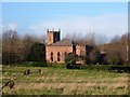
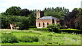
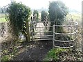
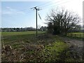
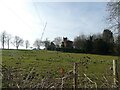
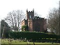
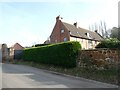
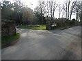
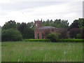
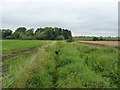
17 photos from this area
Area Information
Key information about the TF10 8JY including its size, population, and administrative classification.
- Area Type
- Postcode
- Area Size
- 38.9 hectares
- Population
- 1067
- Population Density
- 444 people/km²
House Prices in TF10 8JY
15
Properties
£496,964
Average Sold Price
£60,000
Lowest Price
£1,500,000
Highest Price
Showing 15 properties
| Address | Type | Beds | Baths | Last Sale Price | Last Sale Date | |
|---|---|---|---|---|---|---|
| Provosts House, 44 High Street, Edgmond, Newport, TF10 8JY | Detached | 7 | 6 | £1,500,000 | Oct 2022 | |
| Edgmond Villa, 42 High Street, Edgmond, Newport, TF10 8JY | house | - | - | £750,000 | Nov 2012 | |
| 38 High Street, Edgmond, Newport, TF10 8JY | Detached | 3 | 2 | £179,250 | May 2012 | |
| 40 High Street, Edgmond, Newport, TF10 8JY | house | - | - | £157,500 | Jul 2010 | |
| The Old Stables, High Street, Edgmond, Newport, TF10 8JY | Semi-detached | 4 | 4 | £522,000 | Mar 2006 | |
| Provost Mews, 46 High Street, Edgmond, Newport, TF10 8JY | house | - | - | £60,000 | Jul 2000 | |
| 39 High Street, Edgmond, Newport, TF10 8JY | Detached | - | - | £310,000 | Mar 2000 | |
| Edgmond Grove, High Street, Edgmond, Newport, TF10 8JY | Equestrian | 5 | - | - | - | |
| 45 High Street, Edgmond, Newport, TF10 8JY | Semi-detached | - | - | - | - | |
| 36 High Street, Edgmond, Newport, TF10 8JY | Detached | - | - | - | - |
Page 1 of 2
Energy Efficiency in TF10 8JY
Amenities
Schools
| Rank | School | Type | Entry gender | Ages |
|---|
Explore more schools in this area
Go to Schools tabDemographics
Household Size
Two person
most common
Accommodation Type
Houses
most common
Tenure
83
majority
Ethnic Group
White
most common
Religion
N/A
most common
Household Composition
N/A
most common
Age
47
median
Adults (30-64 years)
most common
Household Deprivation
N/A
with no deprivation
NS-SEC
44
in Lower managerial occupations
Explore more demographic insights in this area
Go to Demographics tabPlanning
Planning Constraints
- Flood RiskPremium
- Ramsar Wetland SitesPremium
- Area of Outstanding Natural BeautyPremium
- Protected Nature ReservePremium
- Protected WoodlandPremium