Area Overview for TF10 8HL
Photos of TF10 8HL
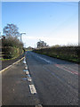
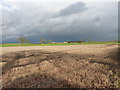
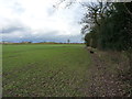
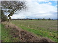


10 photos from this area
Area Information
Key information about the TF10 8HL including its size, population, and administrative classification.
- Area Type
- Postcode
- Area Size
- 29.4 hectares
- Population
- 1067
- Population Density
- 444 people/km²
House Prices in TF10 8HL
25
Properties
£179,647
Average Sold Price
£42,000
Lowest Price
£258,000
Highest Price
Showing 25 properties
| Address | Type | Beds | Baths | Last Sale Price | Last Sale Date | |
|---|---|---|---|---|---|---|
| 41 Chetwynd Road, Edgmond, Newport, TF10 8HL | Semi-detached | 2 | 1 | £240,000 | Aug 2024 | |
| 19 Chetwynd Road, Edgmond, Newport, TF10 8HL | house | - | - | £225,000 | Jul 2022 | |
| 28 Chetwynd Road, Edgmond, Newport, TF10 8HL | house | - | - | £180,000 | Feb 2021 | |
| 26 Chetwynd Road, Edgmond, Newport, TF10 8HL | house | - | - | £205,000 | Oct 2020 | |
| 31 Chetwynd Road, Edgmond, Newport, TF10 8HL | house | - | - | £125,000 | Oct 2020 | |
| 33 Chetwynd Road, Edgmond, Newport, TF10 8HL | house | 3 | 1 | £220,000 | Sep 2020 | |
| Mulligans Corner, 11 Chetwynd Road, Edgmond, Newport, TF10 8HL | Semi-detached | 3 | 1 | £207,500 | Mar 2020 | |
| 34 Chetwynd Road, Edgmond, Newport, TF10 8HL | Bungalow | 2 | 1 | £258,000 | May 2015 | |
| 32 Chetwynd Road, Edgmond, Newport, TF10 8HL | house | - | - | £246,000 | Oct 2012 | |
| 38 Chetwynd Road, Edgmond, Newport, TF10 8HL | Bungalow | - | - | £246,000 | Dec 2009 |
Page 1 of 3
Energy Efficiency in TF10 8HL
Amenities
Schools
| Rank | School | Type | Entry gender | Ages |
|---|
Explore more schools in this area
Go to Schools tabDemographics
Household Size
Two person
most common
Accommodation Type
Houses
most common
Tenure
83
majority
Ethnic Group
White
most common
Religion
N/A
most common
Household Composition
N/A
most common
Age
47
median
Adults (30-64 years)
most common
Household Deprivation
N/A
with no deprivation
NS-SEC
44
in Lower managerial occupations
Explore more demographic insights in this area
Go to Demographics tabPlanning
Planning Constraints
- Flood RiskPremium
- Ramsar Wetland SitesPremium
- Area of Outstanding Natural BeautyPremium
- Protected Nature ReservePremium
- Protected WoodlandPremium