Area Overview for TF1 5HG
Photos of TF1 5HG


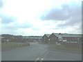


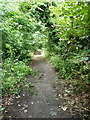
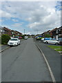
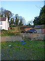
31 photos from this area
Area Information
Key information about the TF1 5HG including its size, population, and administrative classification.
- Area Type
- Postcode
- Area Size
- 6.8 hectares
- Population
- 1721
- Population Density
- 2645 people/km²
House Prices in TF1 5HG
25
Properties
£132,696
Average Sold Price
£41,500
Lowest Price
£217,000
Highest Price
Showing 25 properties
| Address | Type | Beds | Baths | Last Sale Price | Last Sale Date | |
|---|---|---|---|---|---|---|
| 35 Riddings Close, Ketley, Telford, TF1 5HG | Semi-detached | 3 | 1 | £205,000 | Mar 2025 | |
| 27 Riddings Close, Ketley, Telford, TF1 5HG | Semi-detached | 3 | 1 | £217,000 | Feb 2024 | |
| 43 Riddings Close, Ketley, Telford, TF1 5HG | Semi-detached | 3 | 1 | £207,750 | Mar 2023 | |
| 33 Riddings Close, Ketley, Telford, TF1 5HG | house | - | - | £105,000 | Sep 2021 | |
| 22 Riddings Close, Ketley, Telford, TF1 5HG | house | - | - | £170,000 | Nov 2020 | |
| 41 Riddings Close, Ketley, Telford, TF1 5HG | Semi-detached | 3 | 1 | £146,500 | Aug 2018 | |
| 23 Riddings Close, Ketley, Telford, TF1 5HG | house | - | - | £140,000 | Nov 2017 | |
| 37 Riddings Close, Ketley, Telford, TF1 5HG | Semi-detached | 3 | 1 | £120,500 | Dec 2014 | |
| 28 Riddings Close, Ketley, Telford, TF1 5HG | Semi-detached | 3 | - | £122,500 | Nov 2013 | |
| 20 Riddings Close, Ketley, Telford, TF1 5HG | house | - | - | £115,000 | Dec 2012 |
Page 1 of 3
Energy Efficiency in TF1 5HG
Amenities
Schools
| Rank | School | Type | Entry gender | Ages |
|---|
Explore more schools in this area
Go to Schools tabDemographics
Household Size
Two person
most common
Accommodation Type
Houses
most common
Tenure
60
majority
Ethnic Group
White
most common
Religion
N/A
most common
Household Composition
N/A
most common
Age
47
median
Adults (30-64 years)
most common
Household Deprivation
N/A
with no deprivation
NS-SEC
27
in Lower managerial occupations
Explore more demographic insights in this area
Go to Demographics tabPlanning
Planning Constraints
- Flood RiskPremium
- Ramsar Wetland SitesPremium
- Area of Outstanding Natural BeautyPremium
- Protected Nature ReservePremium
- Protected WoodlandPremium