Area Overview for TF1 2HY
Photos of TF1 2HY
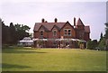

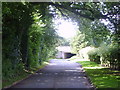
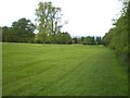

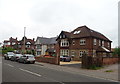
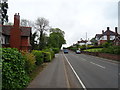

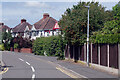
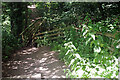


60 photos from this area
Area Information
Key information about the TF1 2HY including its size, population, and administrative classification.
- Area Type
- Postcode
- Area Size
- 1.0 hectares
- Population
- 2369
- Population Density
- 5594 people/km²
House Prices in TF1 2HY
20
Properties
£130,621
Average Sold Price
£44,500
Lowest Price
£191,500
Highest Price
Showing 20 properties
| Address | Type | Beds | Baths | Last Sale Price | Last Sale Date | |
|---|---|---|---|---|---|---|
| 5C Forester Grove, Arleston, Telford, TF1 2HY | Semi-detached | 3 | 1 | £175,000 | Jun 2023 | |
| 8 Forester Grove, Arleston, Telford, TF1 2HY | Terraced | 3 | 1 | £152,000 | Jul 2022 | |
| 10 Forester Grove, Arleston, Telford, TF1 2HY | Terraced | 3 | 1 | £171,000 | Mar 2020 | |
| 1 Forester Grove, Arleston, Telford, TF1 2HY | Semi-detached | 3 | 1 | £136,000 | Jun 2019 | |
| 5D Forester Grove, Arleston, Telford, TF1 2HY | Semi-detached | 3 | 1 | £142,500 | Oct 2018 | |
| 14 Forester Grove, Arleston, Telford, TF1 2HY | Semi-detached | 3 | 1 | £100,000 | Oct 2017 | |
| 4 Forester Grove, Arleston, Telford, TF1 2HY | Terraced | - | - | £65,000 | Oct 2017 | |
| 5 Forester Grove, Arleston, Telford, TF1 2HY | Terraced | 3 | 1 | £191,500 | Aug 2017 | |
| 5E Forester Grove, Arleston, Telford, TF1 2HY | Flat | 2 | 1 | £147,950 | Jun 2017 | |
| 5F Forester Grove, Arleston, Telford, TF1 2HY | house | - | - | £144,500 | May 2017 |
Page 1 of 2
Energy Efficiency in TF1 2HY
Amenities
Schools
| Rank | School | Type | Entry gender | Ages |
|---|
Explore more schools in this area
Go to Schools tabDemographics
Household Size
Family (3-5 people)
most common
Accommodation Type
Houses
most common
Tenure
46
majority
Ethnic Group
White
most common
Religion
N/A
most common
Household Composition
N/A
most common
Age
47
median
Adults (30-64 years)
most common
Household Deprivation
N/A
with no deprivation
NS-SEC
19
in Lower managerial occupations
Explore more demographic insights in this area
Go to Demographics tabPlanning
Planning Constraints
- Flood RiskPremium
- Ramsar Wetland SitesPremium
- Area of Outstanding Natural BeautyPremium
- Protected Nature ReservePremium
- Protected WoodlandPremium