Lock near Glascote, Tamworth in Tamworth
A view of part of the Town centre Road System in Tamworth
A pathway and former Road behind the Odeon Ten Screen Cinema in Tamworth
Another view of Mill Lane in Tamworth
A view of  a Pedestrian crossing in Tamworth
Bolebridge Island, Car Park  (1) in Tamworth
A Pathway between Mill Lane and Bolebridge Street. in Tamworth
Saxon Drive connecting with Bolebridge Street  (1) in Tamworth
Bolebridge Street, Car Park  (17) in Tamworth
A view of Bolebridge Street  (11) in Tamworth
Disused road located next to the Odeon Ten screen Cinema. in Tamworth
Glascote Basin on the Coventry Canal at Tamworth in Tamworth
100 photos from this area

Area Information

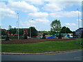
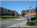
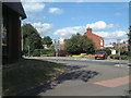
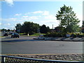
Living in Tamworth offers a compact, well-defined urban experience in central England. Covering 19.7 km², the area is home to 8,802 residents, with a population density of 447 people per square kilometre. This makes it a tightly knit community where local landmarks and services are within easy reach. The town’s character is shaped by its moderate size and proximity to surrounding rural areas, offering a balance between urban convenience and natural surroundings. Tamworth’s low crime risk score of 67 means residents can enjoy a sense of security, while its transport links—including four railway stations and a bus interchange—provide practical access to nearby towns and cities. The area’s schools, ranging from nurseries to primary schools, cater to families, and the presence of local shops and amenities ensures daily needs are met without long commutes. For those seeking a quiet, connected town with a strong sense of community, Tamworth’s blend of practicality and accessibility makes it a compelling choice.

Area Type
District/Borough
Area Size
19.7 km²
Population
8802
Population Density
447 people/km²

Demographics

Tamworth’s population has a median age of 70, reflecting a community skewed towards older residents. This age profile suggests a demographic where retirement and long-term residency dominate, with fewer younger families compared to other areas. Home ownership in Tamworth stands at 68%, indicating a stable housing market where most residents live in properties they own. The data does not specify household composition or accommodation types, but the high proportion of owner-occupied homes suggests a settled, long-term population. While the area’s diversity and cultural makeup are not detailed in the data, the population density of 447 per km² implies a mix of residential and possibly commercial land use. For those considering life in Tamworth, the age demographic and ownership rates highlight a community that prioritises stability and familiarity over rapid change.

Household Size

total
most common

Accommodation Type

total
most common

Tenure

68
majority

Ethnic Group

total
most common

Religion

total
most common

Household Composition

total
most common

Age

70
median
Age: Total
most common

Household Deprivation

N/A
with no deprivation

NS-SEC

27
in Lower managerial occupations

Explore more demographic insights in this area

Go to Demographics tab

Planning

Planning Constraints

  • Crime Risk
    Locked

Explore more planning insights in this area

Open Planning map

Frequently Asked Questions

What is the community feel like in Tamworth?
Tamworth has a compact, close-knit community with a median age of 70, suggesting a population skewed towards older residents. The 8,802 residents live in a 19.7 km² area, creating a sense of familiarity and accessibility for local services and amenities.
Who lives in Tamworth?
The population has a median age of 70, with 68% of residents owning their homes. This indicates a community of long-term residents and retirees, with a stable housing market and less emphasis on younger families.
What schools are available near Tamworth?
Tamworth has five schools, including nurseries and primary schools such as Tamworth Early Years Centre, Coton Green Primary School, and Lark Hall Community Infant School. These provide education for children from early years through to primary level.
How is transport and connectivity in Tamworth?
The area has a broadband score of 100 (excellent) and mobile coverage of 85 (good). It also includes a bus interchange and four railway stations, offering practical links to nearby towns and cities.
Is Tamworth a safe place to live?
Tamworth has a low crime risk score of 67, indicating below-average crime rates. This suggests a generally safe environment for residents, though specific crime data is not detailed in the assessment.

We use cookies to provide you with the best experience. By continuing, you agree to our Cookie Policy .