Area Overview for SY8 4DS
Photos of SY8 4DS

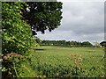
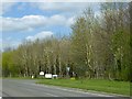
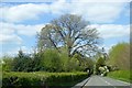
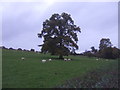
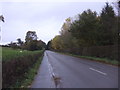
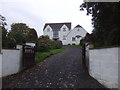
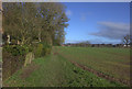
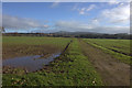

31 photos from this area
Area Information
Key information about the SY8 4DS including its size, population, and administrative classification.
- Area Type
- Postcode
- Area Size
- 54.7 hectares
- Population
- 1901
- Population Density
- 210 people/km²
House Prices in SY8 4DS
21
Properties
£388,792
Average Sold Price
£86,000
Lowest Price
£725,000
Highest Price
Showing 21 properties
| Address | Type | Beds | Baths | Last Sale Price | Last Sale Date | |
|---|---|---|---|---|---|---|
| Koala Cottage, Lower Barns Road, Ludford, Ludlow, SY8 4DS | Bungalow | - | - | £725,000 | Oct 2021 | |
| Carnlair, Lower Barns Road, Ludford, Ludlow, SY8 4DS | house | - | - | £485,000 | Sep 2021 | |
| Buena Vista, Lower Barns Road, Ludford, Ludlow, SY8 4DS | Bungalow | - | - | £282,500 | Apr 2020 | |
| Neighbridge House, Lower Barns Road, Ludford, Ludlow, SY8 4DS | Detached | 4 | 2 | £550,000 | Sep 2018 | |
| Broadlands, Lower Barns Road, Ludford, Ludlow, SY8 4DS | house | - | - | £400,000 | Apr 2012 | |
| Fairfields, Lower Barns Road, Ludford, Ludlow, SY8 4DS | Detached | - | - | £485,000 | Mar 2008 | |
| Barnsfield House, Lower Barns Road, Ludford, Ludlow, SY8 4DS | Detached | - | - | £535,000 | May 2007 | |
| Barnswood, Lower Barns Road, Ludford, Ludlow, SY8 4DS | Detached | - | - | £455,000 | Jan 2007 | |
| The Pippins, Lower Barns Road, Ludford, Ludlow, SY8 4DS | Bungalow | - | - | £239,500 | Aug 2003 | |
| The Leys, Lower Barns Road, Ludford, Ludlow, SY8 4DS | Detached | - | - | £330,000 | Jul 2002 |
Page 1 of 3
Energy Efficiency in SY8 4DS
Amenities
Schools
| Rank | School | Type | Entry gender | Ages |
|---|
Explore more schools in this area
Go to Schools tabDemographics
Household Size
Two person
most common
Accommodation Type
Houses
most common
Tenure
74
majority
Ethnic Group
White
most common
Religion
N/A
most common
Household Composition
N/A
most common
Age
47
median
Adults (30-64 years)
most common
Household Deprivation
N/A
with no deprivation
NS-SEC
29
in Lower managerial occupations
Explore more demographic insights in this area
Go to Demographics tabPlanning
Planning Constraints
- Flood RiskPremium
- Ramsar Wetland SitesPremium
- Area of Outstanding Natural BeautyPremium
- Protected Nature ReservePremium
- Protected WoodlandPremium