Area Overview for SY8 4AU
Photos of SY8 4AU
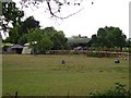
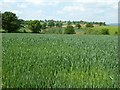
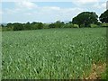
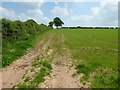
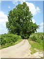
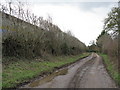
6 photos from this area
Area Information
Key information about the SY8 4AU including its size, population, and administrative classification.
- Area Type
- Postcode
- Area Size
- 1.9 km²
- Population
- 1743
- Population Density
- 33 people/km²
House Prices in SY8 4AU
15
Properties
£461,200
Average Sold Price
£112,000
Lowest Price
£824,000
Highest Price
Showing 15 properties
| Address | Type | Beds | Baths | Last Sale Price | Last Sale Date | |
|---|---|---|---|---|---|---|
| Brookfield, U 95006 Little Hereford, Little Hereford, SY8 4AU | Detached | 4 | - | £540,000 | Jan 2025 | |
| The Pulpits, Field Lane, Little Hereford, SY8 4AU | Detached | - | - | £824,000 | Mar 2023 | |
| Gable West, U 95006 Little Hereford, Little Hereford, SY8 4AU | house | - | - | £675,000 | Jun 2010 | |
| Westbrook Farm, Westbrook Road, Little Hereford, SY8 4AU | Detached | - | - | £155,000 | Oct 2001 | |
| Little Westiebrook Cottage, U 95006 Little Hereford, Little Hereford, SY8 4AU | house | - | - | £112,000 | Nov 1999 | |
| Field Farm, U 94408 Little Hereford, Little Hereford, SY8 4AU | Semi-detached | - | - | - | - | |
| Stable Meadow, U 94408 Little Hereford, Little Hereford, SY8 4AU | Semi-detached | 4 | - | - | - | |
| Annexe, The Pulpits, Field Lane, Little Hereford, SY8 4AU | Semi-detached | - | - | - | - | |
| Westbrook Cottage, Westbrook Road, Little Hereford, SY8 4AU | Detached | - | - | - | - | |
| Pulpits Farm, U 94408 Little Hereford, Little Hereford, SY8 4AU | house | - | - | - | - |
Page 1 of 2
Energy Efficiency in SY8 4AU
Amenities
Schools
| Rank | School | Type | Entry gender | Ages |
|---|
Explore more schools in this area
Go to Schools tabDemographics
Household Size
Two person
most common
Accommodation Type
Houses
most common
Tenure
80
majority
Ethnic Group
White
most common
Religion
N/A
most common
Household Composition
N/A
most common
Age
47
median
Adults (30-64 years)
most common
Household Deprivation
N/A
with no deprivation
NS-SEC
38
in Lower managerial occupations
Explore more demographic insights in this area
Go to Demographics tabPlanning
Planning Constraints
- Flood RiskPremium
- Ramsar Wetland SitesPremium
- Area of Outstanding Natural BeautyPremium
- Protected Nature ReservePremium
- Protected WoodlandPremium