Area Overview for SY8 3BP
Photos of SY8 3BP

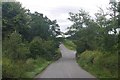
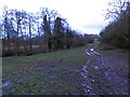
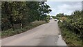


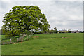
7 photos from this area
Area Information
Key information about the SY8 3BP including its size, population, and administrative classification.
- Area Type
- Postcode
- Area Size
- 79.0 hectares
- Population
- 1287
- Population Density
- 51 people/km²
House Prices in SY8 3BP
11
Properties
£403,833
Average Sold Price
£137,000
Lowest Price
£510,000
Highest Price
Showing 11 properties
| Address | Type | Beds | Baths | Last Sale Price | Last Sale Date | |
|---|---|---|---|---|---|---|
| The Paddocks, The Serpent Junction To Caynham Road End Of, Caynham, SY8 3BP | house | - | - | £510,000 | Sep 2022 | |
| Glen House, The Serpent Junction To Caynham Road End Of, Caynham, SY8 3BP | Detached | 4 | 2 | £500,000 | Aug 2022 | |
| Hillcot, The Serpent Junction To Caynham Road End Of, Caynham, SY8 3BP | Detached | 4 | 3 | £485,000 | Sep 2019 | |
| Firs, The Serpent Junction To Caynham Road End Of, Caynham, SY8 3BP | house | - | - | £356,000 | Oct 2014 | |
| Meadowbrook House, The Serpent Junction To Caynham Road End Of, Caynham, SY8 3BP | house | - | - | £435,000 | Jan 2010 | |
| Odhams Meadow, The Serpent Junction To Caynham Road End Of, Caynham, SY8 3BP | Detached | - | - | £137,000 | Jul 1998 | |
| Pervin, The Serpent Junction To Caynham Road End Of, Caynham, SY8 3BP | Detached | 6 | 4 | - | - | |
| Mayfield, The Serpent Junction To Caynham Road End Of, Caynham, SY8 3BP | Detached | - | - | - | - | |
| Oak Cottage, The Serpent Junction To Caynham Road End Of, Caynham, SY8 3BP | house | - | - | - | - | |
| The Pound, The Serpent Junction To Caynham Road End Of, Caynham, SY8 3BP | Detached | - | - | - | - |
Page 1 of 2
Energy Efficiency in SY8 3BP
Amenities
Schools
| Rank | School | Type | Entry gender | Ages |
|---|
Explore more schools in this area
Go to Schools tabDemographics
Household Size
Two person
most common
Accommodation Type
Houses
most common
Tenure
85
majority
Ethnic Group
White
most common
Religion
N/A
most common
Household Composition
N/A
most common
Age
47
median
Adults (30-64 years)
most common
Household Deprivation
N/A
with no deprivation
NS-SEC
41
in Lower managerial occupations
Explore more demographic insights in this area
Go to Demographics tabPlanning
Planning Constraints
- Flood RiskPremium
- Ramsar Wetland SitesPremium
- Area of Outstanding Natural BeautyPremium
- Protected Nature ReservePremium
- Protected WoodlandPremium