Area Overview for SY8 2PQ
Photos of SY8 2PQ
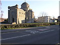
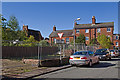
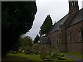
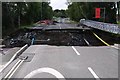
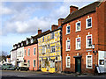
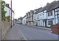
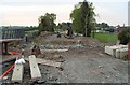
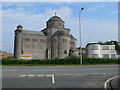
100 photos from this area
Area Information
Key information about the SY8 2PQ including its size, population, and administrative classification.
- Area Type
- Postcode
- Area Size
- 2.1 hectares
- Population
- 1255
- Population Density
- 639 people/km²
House Prices in SY8 2PQ
14
Properties
£202,744
Average Sold Price
£171,000
Lowest Price
£247,000
Highest Price
Showing 14 properties
| Address | Type | Beds | Baths | Last Sale Price | Last Sale Date | |
|---|---|---|---|---|---|---|
| 7 Station Drive, Ludlow, SY8 2PQ | house | - | - | £181,000 | Jan 2023 | |
| 9 Station Drive, Ludlow, SY8 2PQ | house | - | - | £171,000 | May 2021 | |
| 2 Station Drive, Ludlow, SY8 2PQ | Terraced | 2 | 1 | £240,000 | May 2021 | |
| 6 Station Drive, Ludlow, SY8 2PQ | house | - | - | £218,000 | Mar 2019 | |
| Bockleton, Station Drive, Ludlow, SY8 2PQ | house | - | - | £247,000 | Jun 2018 | |
| 8 Station Drive, Ludlow, SY8 2PQ | Terraced | - | - | £210,000 | Aug 2014 | |
| 5 Station Drive, Ludlow, SY8 2PQ | Retail | 2 | 1 | £179,950 | Aug 2012 | |
| 1 Station Drive, Ludlow, SY8 2PQ | house | - | - | £175,000 | May 2006 | |
| Ludlow Railway Station, Station Drive, Ludlow, SY8 2PQ | retail_financial | - | - | - | - | |
| Maries, The Stables, Station Drive, Ludlow, SY8 2PQ | Restaurant | - | - | - | - |
Page 1 of 2
Energy Efficiency in SY8 2PQ
Amenities
Schools
| Rank | School | Type | Entry gender | Ages |
|---|
Explore more schools in this area
Go to Schools tabDemographics
Household Size
One person
most common
Accommodation Type
Houses
most common
Tenure
71
majority
Ethnic Group
White
most common
Religion
N/A
most common
Household Composition
N/A
most common
Age
70
median
Elderly (65+ years)
most common
Household Deprivation
N/A
with no deprivation
NS-SEC
43
in Lower managerial occupations
Explore more demographic insights in this area
Go to Demographics tabPlanning
Planning Constraints
- Flood RiskPremium
- Ramsar Wetland SitesPremium
- Area of Outstanding Natural BeautyPremium
- Protected Nature ReservePremium
- Protected WoodlandPremium