Area Overview for SY8 2NY
Photos of SY8 2NY
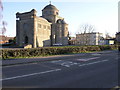
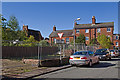
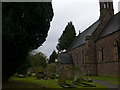
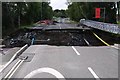
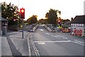
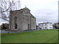
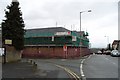
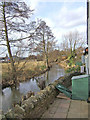
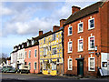
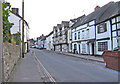
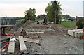
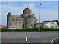
100 photos from this area
Area Information
Key information about the SY8 2NY including its size, population, and administrative classification.
- Area Type
- Postcode
- Area Size
- 1.9 hectares
- Population
- 1230
- Population Density
- 2329 people/km²
House Prices in SY8 2NY
20
Properties
£267,892
Average Sold Price
£74,600
Lowest Price
£725,000
Highest Price
Showing 20 properties
| Address | Type | Beds | Baths | Last Sale Price | Last Sale Date | |
|---|---|---|---|---|---|---|
| 1, Zion Chapel, New Road, Ludlow, SY8 2NY | Terraced | 3 | 2 | £220,000 | Nov 2025 | |
| 29 New Road, Ludlow, SY8 2NY | Terraced | 2 | 1 | £172,000 | Dec 2024 | |
| 21 New Road, Ludlow, SY8 2NY | house | - | - | £153,750 | May 2022 | |
| 4, Zion Chapel, New Road, Ludlow, SY8 2NY | house | 3 | - | £390,000 | Jun 2021 | |
| Guy Harlings, New Road, Ludlow, SY8 2NY | Bungalow | 2 | - | £725,000 | Jan 2020 | |
| 25 New Road, Ludlow, SY8 2NY | house | - | - | £74,600 | Nov 2019 | |
| 39 New Road, Ludlow, SY8 2NY | house | - | - | £335,000 | Jun 2018 | |
| 35 New Road, Ludlow, SY8 2NY | Bungalow | - | - | £315,000 | Dec 2017 | |
| 27 New Road, Ludlow, SY8 2NY | Cottage | 2 | 1 | £133,250 | Jan 2016 | |
| 2, Zion Chapel, New Road, Ludlow, SY8 2NY | Semi-detached | 3 | 2 | £190,000 | Aug 2014 |
Page 1 of 2
Energy Efficiency in SY8 2NY
Amenities
Schools
| Rank | School | Type | Entry gender | Ages |
|---|
Explore more schools in this area
Go to Schools tabDemographics
Household Size
Two person
most common
Accommodation Type
Houses
most common
Tenure
80
majority
Ethnic Group
White
most common
Religion
N/A
most common
Household Composition
N/A
most common
Age
47
median
Adults (30-64 years)
most common
Household Deprivation
N/A
with no deprivation
NS-SEC
31
in Lower managerial occupations
Explore more demographic insights in this area
Go to Demographics tabPlanning
Planning Constraints
- Flood RiskPremium
- Ramsar Wetland SitesPremium
- Area of Outstanding Natural BeautyPremium
- Protected Nature ReservePremium
- Protected WoodlandPremium