Area Overview for SY8 1XP
Photos of SY8 1XP
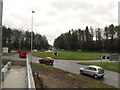
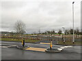
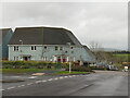
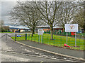
69 photos from this area
Area Information
Key information about the SY8 1XP including its size, population, and administrative classification.
- Area Type
- Postcode
- Area Size
- 8346 m²
- Population
- 1521
- Population Density
- 3589 people/km²
House Prices in SY8 1XP
15
Properties
£252,763
Average Sold Price
£133,000
Lowest Price
£440,000
Highest Price
Showing 15 properties
| Address | Type | Beds | Baths | Last Sale Price | Last Sale Date | |
|---|---|---|---|---|---|---|
| 4 Bitterley Close, Ludlow, SY8 1XP | Detached | 4 | 2 | £440,000 | Feb 2023 | |
| 3 Bitterley Close, Ludlow, SY8 1XP | Detached | 4 | 2 | £420,000 | Aug 2022 | |
| 8 Bitterley Close, Ludlow, SY8 1XP | Detached | 4 | 2 | £370,000 | Jul 2022 | |
| 10 Bitterley Close, Ludlow, SY8 1XP | house | - | - | £400,000 | May 2022 | |
| 6 Bitterley Close, Ludlow, SY8 1XP | house | - | - | £225,000 | Jul 2015 | |
| 15 Bitterley Close, Ludlow, SY8 1XP | house | - | - | £247,500 | Aug 2014 | |
| 1 Bitterley Close, Ludlow, SY8 1XP | Detached | 4 | 2 | £249,950 | Jul 2012 | |
| 11 Bitterley Close, Ludlow, SY8 1XP | Detached | 4 | - | £216,000 | Jul 2012 | |
| 9 Bitterley Close, Ludlow, SY8 1XP | Detached | - | - | £231,000 | Jun 2012 | |
| 13 Bitterley Close, Ludlow, SY8 1XP | Detached | - | - | £200,000 | Apr 2004 |
Page 1 of 2
Energy Efficiency in SY8 1XP
Amenities
Schools
| Rank | School | Type | Entry gender | Ages |
|---|
Explore more schools in this area
Go to Schools tabDemographics
Household Size
One person
most common
Accommodation Type
Houses
most common
Tenure
69
majority
Ethnic Group
White
most common
Religion
N/A
most common
Household Composition
N/A
most common
Age
47
median
Elderly (65+ years)
most common
Household Deprivation
N/A
with no deprivation
NS-SEC
31
in Lower managerial occupations
Explore more demographic insights in this area
Go to Demographics tabPlanning
Planning Constraints
- Flood RiskPremium
- Ramsar Wetland SitesPremium
- Area of Outstanding Natural BeautyPremium
- Protected Nature ReservePremium
- Protected WoodlandPremium