Area Overview for SY8 1UE
Photos of SY8 1UE
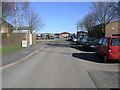
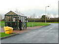
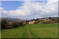
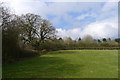
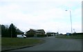
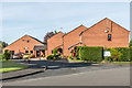
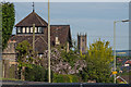
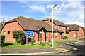
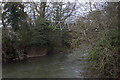
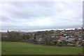
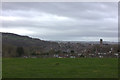
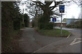
100 photos from this area
Area Information
Key information about the SY8 1UE including its size, population, and administrative classification.
- Area Type
- Postcode
- Area Size
- 1.5 hectares
- Population
- 1901
- Population Density
- 210 people/km²
House Prices in SY8 1UE
27
Properties
£200,079
Average Sold Price
£96,500
Lowest Price
£320,000
Highest Price
Showing 27 properties
| Address | Type | Beds | Baths | Last Sale Price | Last Sale Date | |
|---|---|---|---|---|---|---|
| 33 Blashfield Road, Ludlow, SY8 1UE | Detached | 3 | 1 | £295,000 | Jul 2024 | |
| 8 Blashfield Road, Ludlow, SY8 1UE | house | - | - | £320,000 | May 2023 | |
| 3 Blashfield Road, Ludlow, SY8 1UE | house | - | - | £277,500 | Nov 2021 | |
| 12 Blashfield Road, Ludlow, SY8 1UE | Detached | 3 | 2 | £278,000 | May 2021 | |
| 14 Blashfield Road, Ludlow, SY8 1UE | house | - | - | £225,000 | May 2014 | |
| 27 Blashfield Road, Ludlow, SY8 1UE | house | - | - | £175,000 | Aug 2013 | |
| 15 Blashfield Road, Ludlow, SY8 1UE | house | - | - | £176,000 | Jul 2013 | |
| 31 Blashfield Road, Ludlow, SY8 1UE | house | - | - | £176,000 | Dec 2012 | |
| 10 Blashfield Road, Ludlow, SY8 1UE | house | - | - | £190,000 | Nov 2012 | |
| 35 Blashfield Road, Ludlow, SY8 1UE | house | - | - | £179,000 | Jul 2012 |
Page 1 of 3
Energy Efficiency in SY8 1UE
Amenities
Schools
| Rank | School | Type | Entry gender | Ages |
|---|
Explore more schools in this area
Go to Schools tabDemographics
Household Size
Two person
most common
Accommodation Type
Houses
most common
Tenure
74
majority
Ethnic Group
White
most common
Religion
N/A
most common
Household Composition
N/A
most common
Age
47
median
Adults (30-64 years)
most common
Household Deprivation
N/A
with no deprivation
NS-SEC
29
in Lower managerial occupations
Explore more demographic insights in this area
Go to Demographics tabPlanning
Planning Constraints
- Flood RiskPremium
- Ramsar Wetland SitesPremium
- Area of Outstanding Natural BeautyPremium
- Protected Nature ReservePremium
- Protected WoodlandPremium