Area Overview for SY8 1EE
Photos of SY8 1EE
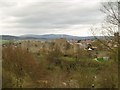
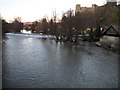
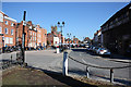
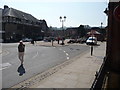
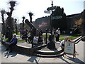
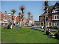
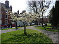
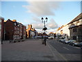
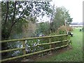
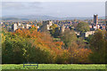
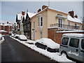
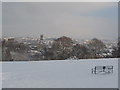
100 photos from this area
Area Information
Key information about the SY8 1EE including its size, population, and administrative classification.
- Area Type
- Postcode
- Area Size
- 23.2 hectares
- Population
- 1255
- Population Density
- 639 people/km²
House Prices in SY8 1EE
49
Properties
£543,291
Average Sold Price
£247,500
Lowest Price
£964,000
Highest Price
Showing 49 properties
| Address | Type | Beds | Baths | Last Sale Price | Last Sale Date | |
|---|---|---|---|---|---|---|
| Bredon, Linney, Ludlow, SY8 1EE | Bungalow | 4 | 2 | £757,500 | Jul 2024 | |
| Linney Cottage, Linney, Ludlow, SY8 1EE | Detached | 7 | 4 | £885,000 | Jun 2024 | |
| The Orchard, Linney, Ludlow, SY8 1EE | Detached | 6 | 5 | £964,000 | Apr 2024 | |
| Drawbridge House, Linney, Ludlow, SY8 1EE | Detached | - | - | £875,000 | Mar 2024 | |
| Rhosymedre, Linney, Ludlow, SY8 1EE | house | 3 | 2 | £650,000 | Dec 2023 | |
| Fairfield, Linney, Ludlow, SY8 1EE | house | - | - | £750,000 | Dec 2022 | |
| 39 Linney, Ludlow, SY8 1EE | house | 3 | 1 | £400,000 | Feb 2022 | |
| West View, Linney, Ludlow, SY8 1EE | house | - | - | £840,000 | Dec 2020 | |
| Trevenna, Linney, Ludlow, SY8 1EE | Detached | 3 | 2 | £315,000 | Dec 2017 | |
| Linfield, Linney, Ludlow, SY8 1EE | Bungalow | - | - | £525,000 | Oct 2017 |
Page 1 of 5
Energy Efficiency in SY8 1EE
Amenities
Schools
| Rank | School | Type | Entry gender | Ages |
|---|
Explore more schools in this area
Go to Schools tabDemographics
Household Size
One person
most common
Accommodation Type
Houses
most common
Tenure
71
majority
Ethnic Group
White
most common
Religion
N/A
most common
Household Composition
N/A
most common
Age
70
median
Elderly (65+ years)
most common
Household Deprivation
N/A
with no deprivation
NS-SEC
43
in Lower managerial occupations
Explore more demographic insights in this area
Go to Demographics tabPlanning
Planning Constraints
- Flood RiskPremium
- Ramsar Wetland SitesPremium
- Area of Outstanding Natural BeautyPremium
- Protected Nature ReservePremium
- Protected WoodlandPremium