Area Overview for SY8 1BQ
Photos of SY8 1BQ
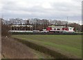
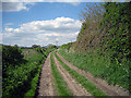
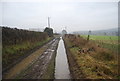
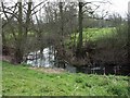
34 photos from this area
Area Information
Key information about the SY8 1BQ including its size, population, and administrative classification.
- Area Type
- Postcode
- Area Size
- 9706 m²
- Population
- 1255
- Population Density
- 639 people/km²
House Prices in SY8 1BQ
18
Properties
£201,171
Average Sold Price
£83,500
Lowest Price
£368,000
Highest Price
Showing 18 properties
| Address | Type | Beds | Baths | Last Sale Price | Last Sale Date | |
|---|---|---|---|---|---|---|
| 12 Keepside Close, Ludlow, SY8 1BQ | Bungalow | 2 | 2 | £300,000 | Jul 2024 | |
| 19 Keepside Close, Ludlow, SY8 1BQ | Semi-detached | 4 | - | £368,000 | Oct 2022 | |
| 14 Keepside Close, Ludlow, SY8 1BQ | house | - | - | £325,000 | Oct 2022 | |
| 11 Keepside Close, Ludlow, SY8 1BQ | Bungalow | - | - | £295,000 | May 2021 | |
| 3 Keepside Close, Ludlow, SY8 1BQ | Bungalow | 3 | 2 | £260,000 | Oct 2020 | |
| 15 Keepside Close, Ludlow, SY8 1BQ | Bungalow | - | - | £289,950 | Dec 2019 | |
| 16 Keepside Close, Ludlow, SY8 1BQ | Bungalow | - | - | £195,000 | Oct 2014 | |
| 7 Keepside Close, Ludlow, SY8 1BQ | house | - | - | £235,000 | Dec 2011 | |
| 18 Keepside Close, Ludlow, SY8 1BQ | Bungalow | - | - | £200,000 | Sep 2010 | |
| 9 Keepside Close, Ludlow, SY8 1BQ | Bungalow | - | - | £195,000 | Jul 2008 |
Page 1 of 2
Energy Efficiency in SY8 1BQ
Amenities
Schools
| Rank | School | Type | Entry gender | Ages |
|---|
Explore more schools in this area
Go to Schools tabDemographics
Household Size
One person
most common
Accommodation Type
Houses
most common
Tenure
71
majority
Ethnic Group
White
most common
Religion
N/A
most common
Household Composition
N/A
most common
Age
70
median
Elderly (65+ years)
most common
Household Deprivation
N/A
with no deprivation
NS-SEC
43
in Lower managerial occupations
Explore more demographic insights in this area
Go to Demographics tabPlanning
Planning Constraints
- Flood RiskPremium
- Ramsar Wetland SitesPremium
- Area of Outstanding Natural BeautyPremium
- Protected Nature ReservePremium
- Protected WoodlandPremium